
Image: RCAF Burtch 2016

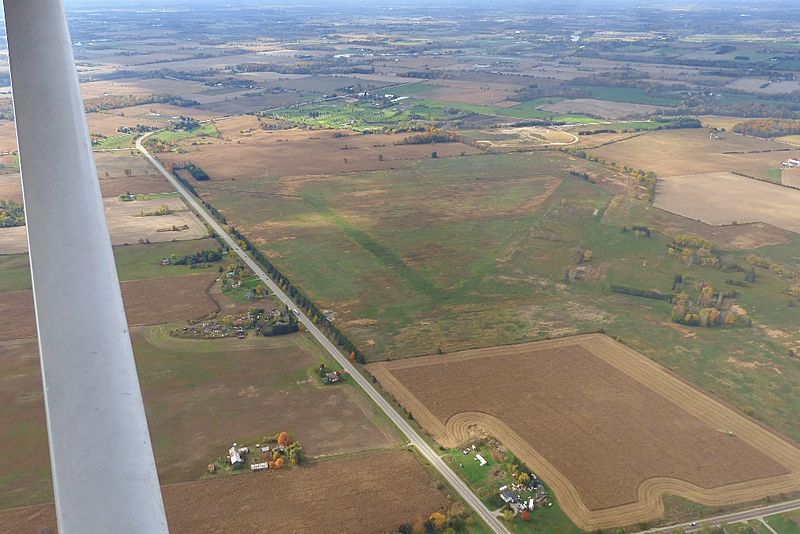
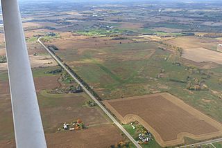
Description: The World War II Royal Canadian Air Force airfield at Burtch, Ontario, Canada, as it was in November 2016. The airfield was built in 1941 as part of the British Commonwealth Air Training Plan. This view, from about 1,000' above ground level, has the camera pointing to southwest. The triangle pattern of the runways is clearly visible, with the intersection of runway 25 (on the right) and 20 (left) at the centre of the frame. Runway 30 is at the top of frame. The hangar and camp area is marked by lines of trees at the right of frame. This airfield was restored to farmland by the Government of Ontario between 2009 and 2015, and then given to a First Nations band in settlement of a land claim. The photograph was taken from the left front seat of Cessna 172 C-GBSL, from a height of 300 metres above ground level. Pilot in command, in the right seat, was Aaron Webb. The white "pole" on the left side of the frame is the left wing strut.
Title: RCAF Burtch 2016
Credit: Own work
Author: J. S. (Steve) Bond
Usage Terms: Creative Commons Attribution-Share Alike 4.0
License: CC BY-SA 4.0
License Link: https://creativecommons.org/licenses/by-sa/4.0
Attribution Required?: Yes
Image usage
The following page links to this image:
