
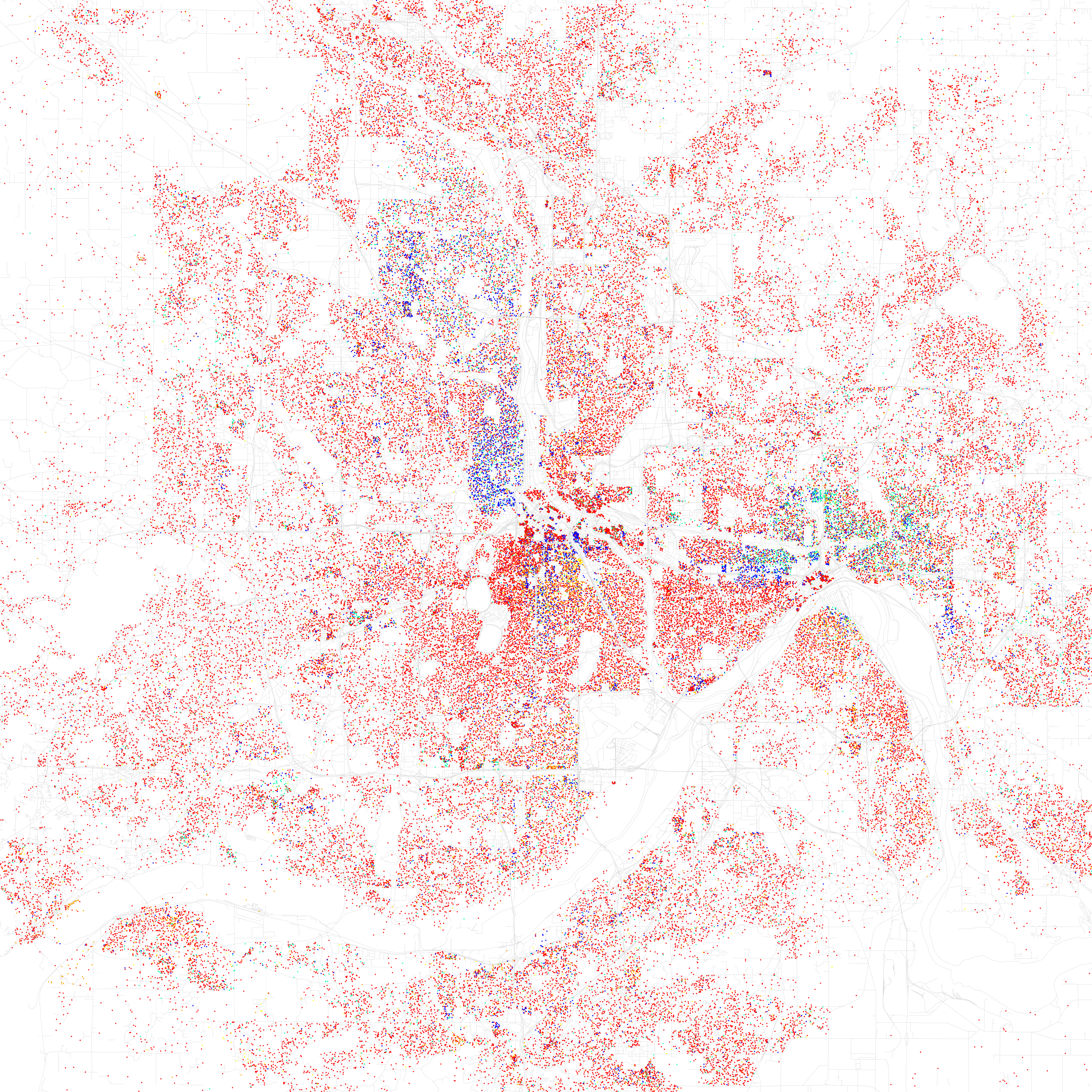
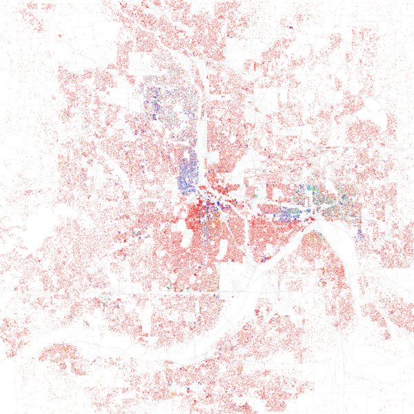
Image: Race and ethnicity 2010- Minneapolis (5560453662)
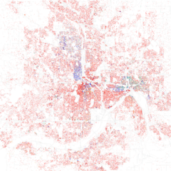
Size of this preview: 600 × 600 pixels. Other resolutions: 240 × 240 pixels | 3,009 × 3,009 pixels.
Original image (3,009 × 3,009 pixels, file size: 2.05 MB, MIME type: image/png)
Description: Maps of racial and ethnic divisions in US cities, inspired by Bill Rankin's map of Chicago, updated for Census 2010. Each dot is 25 people: White, Black, Asian, Hispanic (of any race), or Other (Other is yellow) Data from Census 2010. Base map © OpenStreetMap, CC-BY-SA
Title: Race and ethnicity 2010- Minneapolis (5560453662)
Credit: Race and ethnicity 2010: Minneapolis
Author: Eric Fischer
Usage Terms: Creative Commons Attribution-Share Alike 2.0
License: CC BY-SA 2.0
License Link: https://creativecommons.org/licenses/by-sa/2.0
Attribution Required?: Yes
Image usage
The following 2 pages link to this image:

All content from Kiddle encyclopedia articles (including the article images and facts) can be freely used under Attribution-ShareAlike license, unless stated otherwise.
.png)