
Image: Radar coverage from ground level
Size of this preview: 800 × 419 pixels. Other resolutions: 320 × 168 pixels | 958 × 502 pixels.
Original image (958 × 502 pixels, file size: 203 KB, MIME type: image/png)
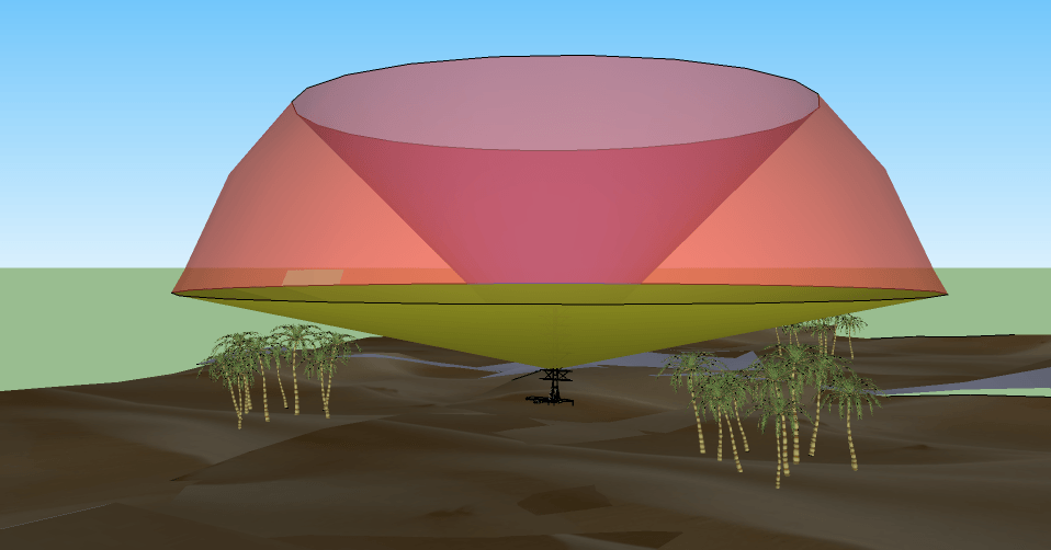
Description: A simple 3D diagram (from Google Sketch) showing a representative radar coverage pattern. The rounded surface is the maximum range of the system (which may be "soft"), the lower limit is selected to avoid reflections from the ground, and the upper surface is the maximum angle, a factor of the antenna design.
Title: Radar coverage from ground level
Credit: Own work
Author: Maury Markowitz
Usage Terms: Creative Commons Attribution-Share Alike 3.0
License: CC BY-SA 3.0
License Link: http://creativecommons.org/licenses/by-sa/3.0
Attribution Required?: Yes
Image usage
The following page links to this image:

All content from Kiddle encyclopedia articles (including the article images and facts) can be freely used under Attribution-ShareAlike license, unless stated otherwise.