
Image: Rael Nuclear use locations world map
Size of this preview: 800 × 351 pixels. Other resolutions: 320 × 140 pixels | 1,425 × 625 pixels.
Original image (1,425 × 625 pixels, file size: 59 KB, MIME type: image/png)
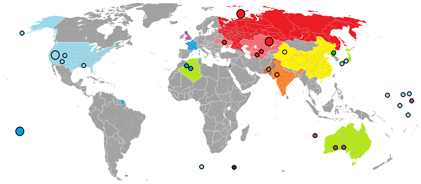
Description: Red: Russia/Soviet Union; blue: France; light blue: United States; purple: United Kingdom. Over 2,000 nuclear explosions have been conducted, in over a dozen different sites around the world. Black Israel, yellow China, orange India, brown Pakistan, green North Korea and light green (territories exposed to nuclear bombs)
Title: Rael Nuclear use locations world map
Credit: in Paint Previously published: 25-07-2012
Author: Palli3000
Usage Terms: Creative Commons Attribution-Share Alike 3.0
License: CC BY-SA 3.0
License Link: http://creativecommons.org/licenses/by-sa/3.0
Attribution Required?: Yes
Image usage
The following 3 pages link to this image:

All content from Kiddle encyclopedia articles (including the article images and facts) can be freely used under Attribution-ShareAlike license, unless stated otherwise.