
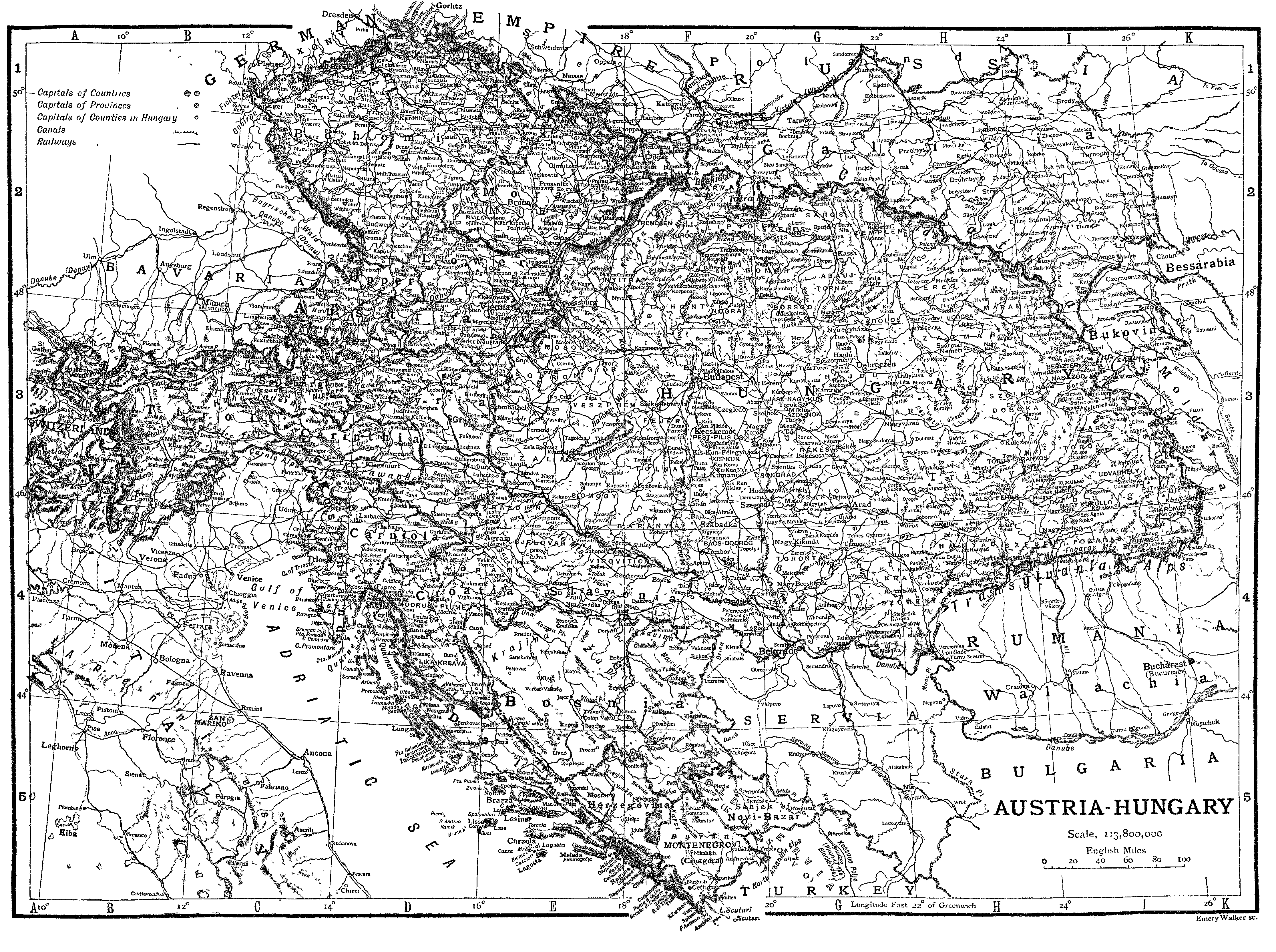
Image: Railway map Austria-Hungary
Size of this preview: 800 × 597 pixels. Other resolutions: 320 × 239 pixels | 4,463 × 3,330 pixels.
Original image (4,463 × 3,330 pixels, file size: 809 KB, MIME type: image/png)
Description: Railway map of the Austro-Hungarian Empire.
Title: Railway map Austria-Hungary
Credit: Austria Hungary article of the ENCYCLOPÆDIA BRITANNICA ELEVENTH EDITION (1911) VOLUME III
Author: ENCYCLOPÆDIA BRITANNICA 1911
Usage Terms: Public domain
License: Public domain
Attribution Required?: No
Image usage
There are no pages that link to this image.

All content from Kiddle encyclopedia articles (including the article images and facts) can be freely used under Attribution-ShareAlike license, unless stated otherwise.