
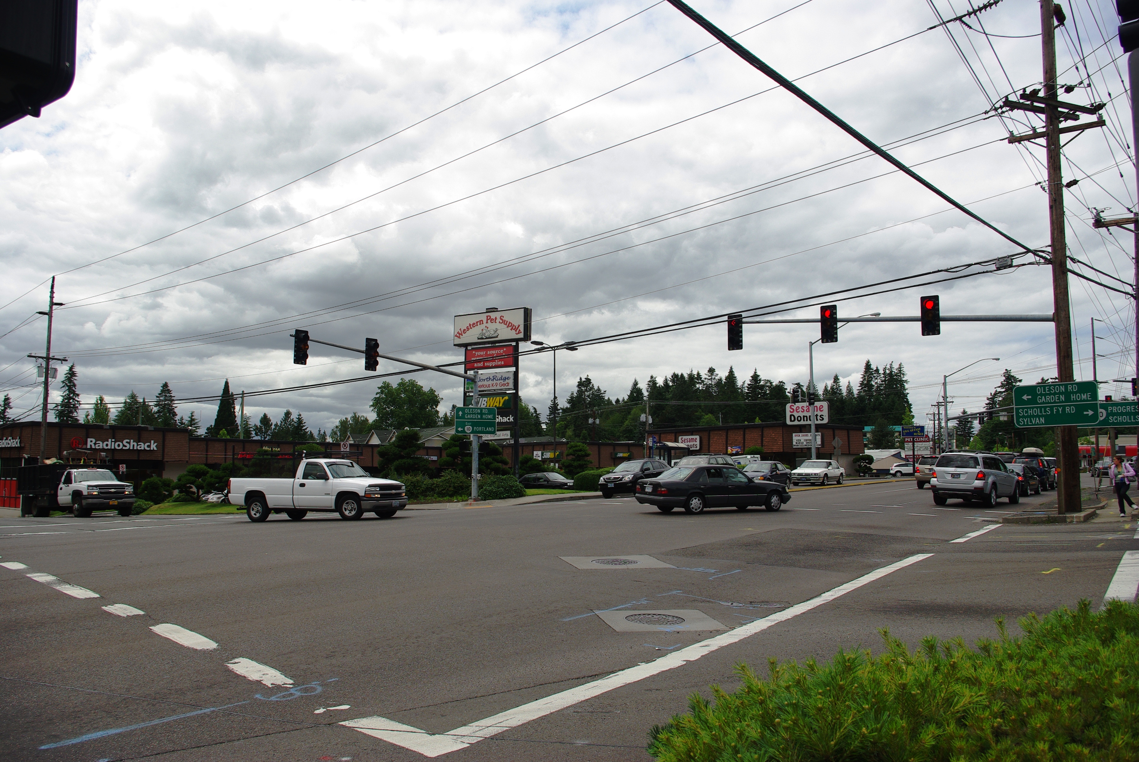
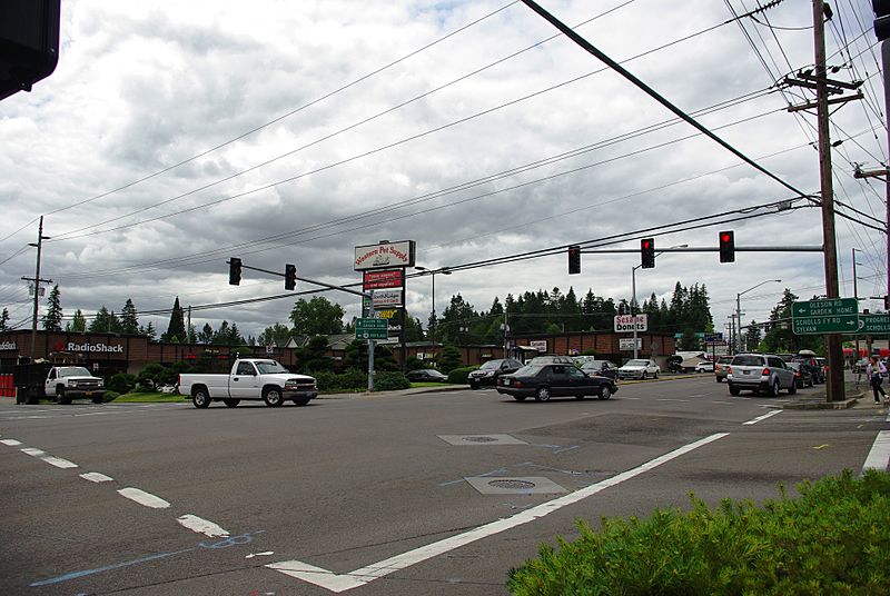
Image: Raleigh Hills OR10 and OR210
Size of this preview: 800 × 536 pixels. Other resolutions: 320 × 214 pixels | 3,872 × 2,592 pixels.
Original image (3,872 × 2,592 pixels, file size: 3.81 MB, MIME type: image/jpeg)
Description: w:Raleigh Hills, Oregon, neighborhood near w:Portland, Oregon. w:Oregon Route 10 (Beaverton-Hillsdale Highway) runs from top to bottom; w:Oregon Route 210 (Scholls Ferry Road) is only visible in the distance underneath the far right red light. Oleson Road is on the left and ends at Scholls Ferry Road off-frame.
Title: Raleigh Hills OR10 and OR210
Credit: Own work
Author: M.O. Stevens
Usage Terms: Public domain
License: Public domain
Attribution Required?: No
Image usage
The following page links to this image:

All content from Kiddle encyclopedia articles (including the article images and facts) can be freely used under Attribution-ShareAlike license, unless stated otherwise.