
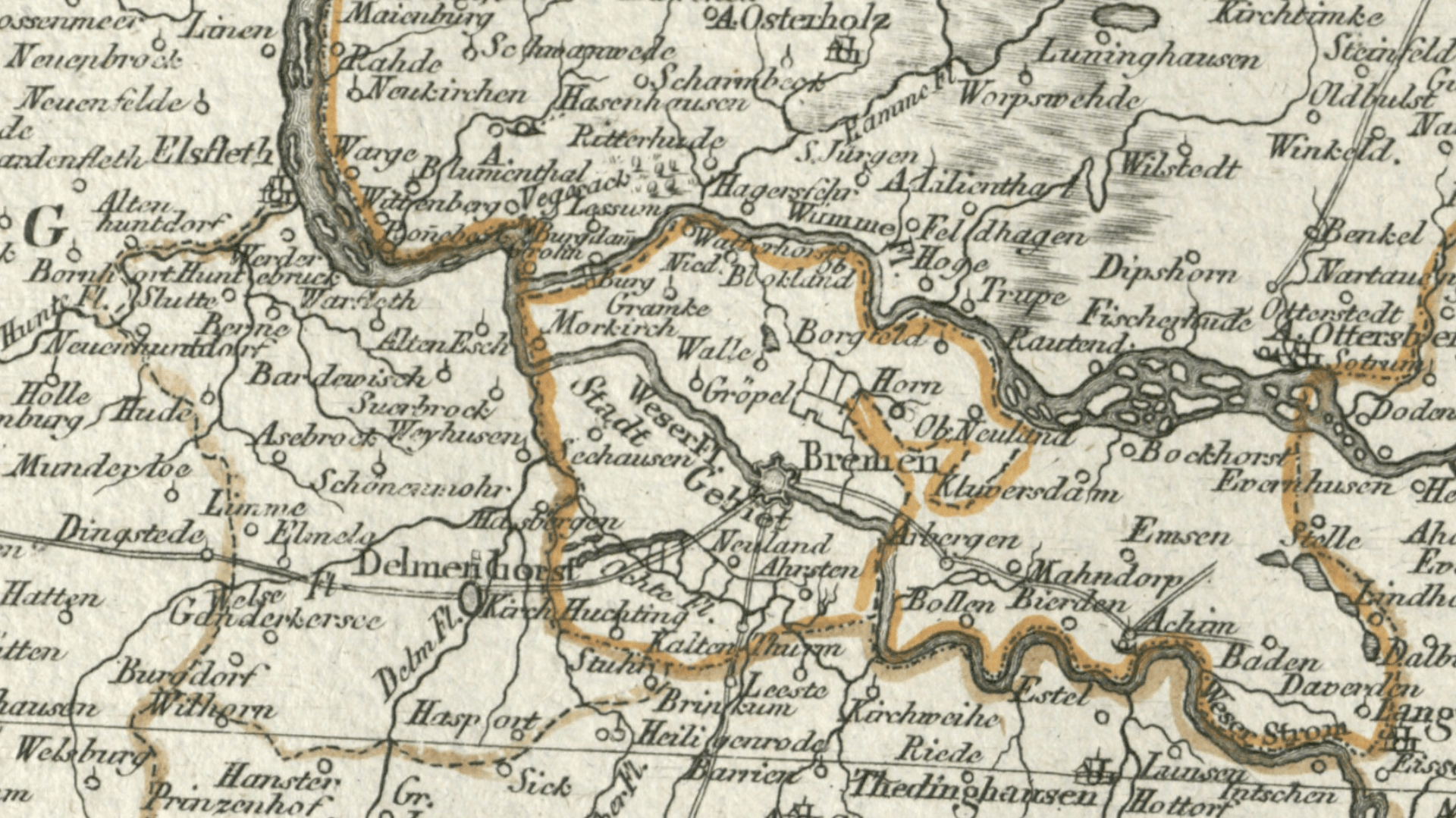
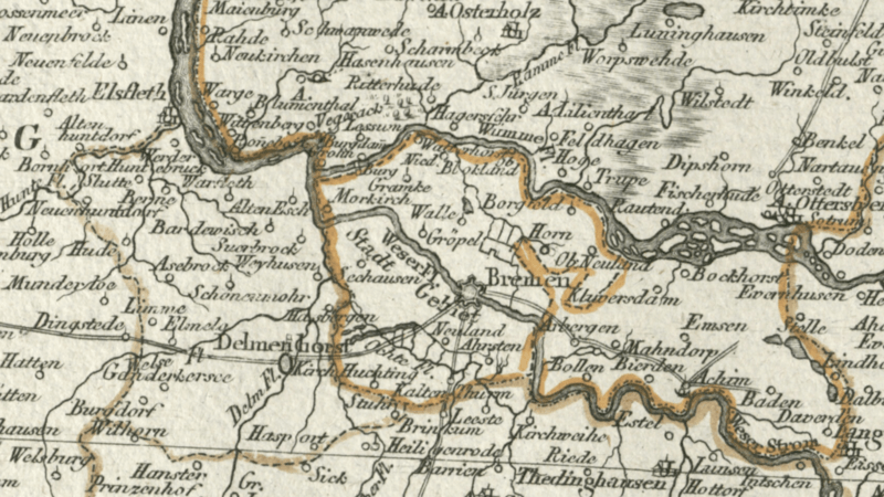
Image: Reichsstadt Bremen Territorium - F.A. Schrämbl, 1797
Size of this preview: 800 × 450 pixels. Other resolutions: 320 × 180 pixels | 1,920 × 1,079 pixels.
Original image (1,920 × 1,079 pixels, file size: 3.78 MB, MIME type: image/png)
Description: Detail cropped out of a late 18th century map showing the territory of the Free Imperial City of Bremen (center). Bremen also called itself the Free and Hanseatic City of Bremen. The territory north and east of Bremen was past of the Duchy of Bremen-Verden. The 24-leaf map, published in 1797 by F. A. Schrämbl was titled Neueste Generalkarte von Deutschland in XXIV Blättern.
Title: Reichsstadt Bremen Territorium - F.A. Schrämbl, 1797
Credit: Moll's map collection
Author: F. A. Schrämbl
Usage Terms: Public domain
License: Public domain
Attribution Required?: No
Image usage
There are no pages that link to this image.

All content from Kiddle encyclopedia articles (including the article images and facts) can be freely used under Attribution-ShareAlike license, unless stated otherwise.