
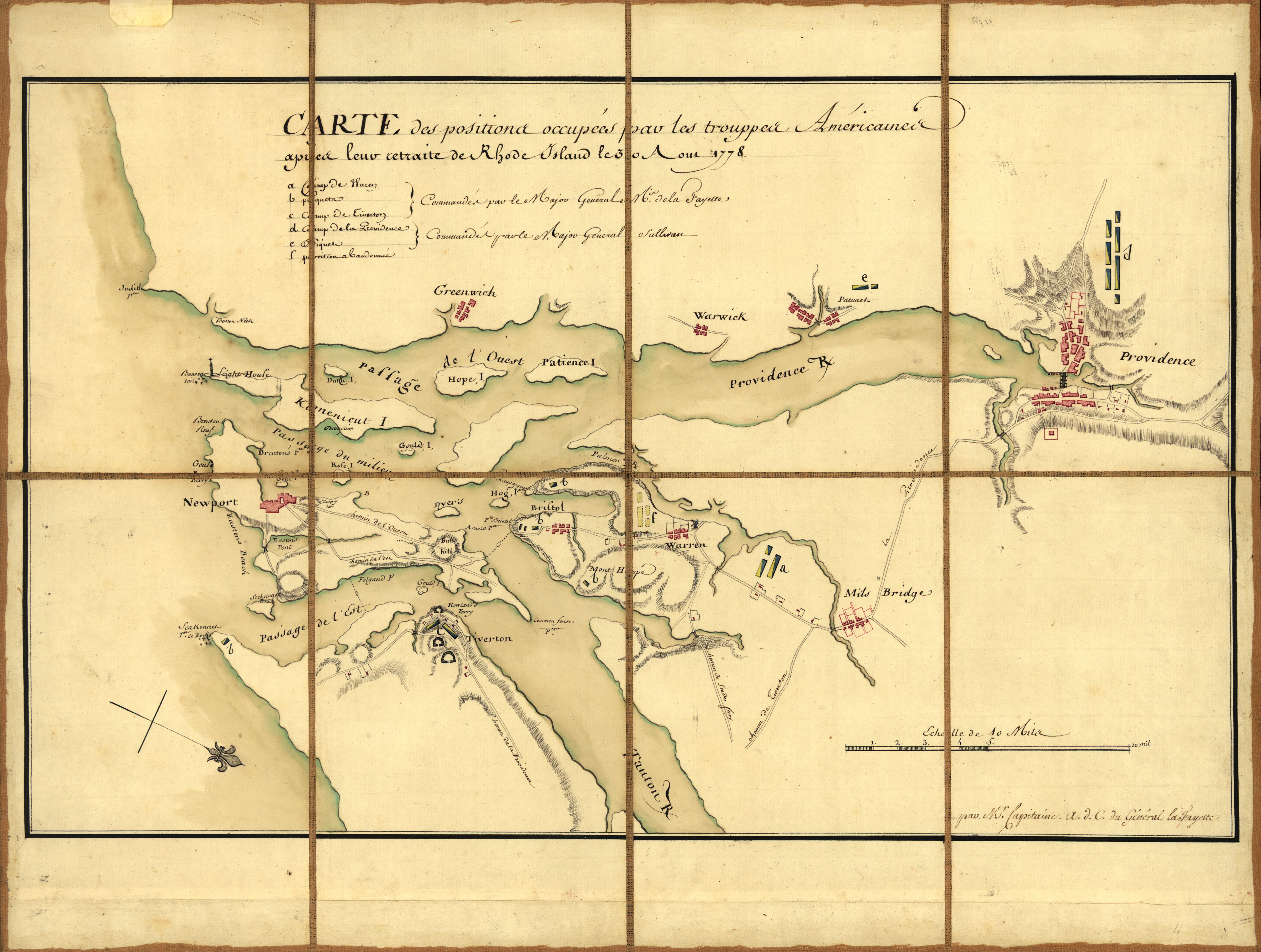
Image: Rhode-island-map
Size of this preview: 794 × 600 pixels. Other resolutions: 318 × 240 pixels | 6,230 × 4,705 pixels.
Original image (6,230 × 4,705 pixels, file size: 3.28 MB, MIME type: image/jpeg)
Description: A French military map prepared for the Marquis de Lafayette showing American troop positions on August 30, 1778, after the Battle of Rhode Island.
Title: Rhode-island-map
Credit: This map is available from the United States Library of Congress's Geography & Map Division under the digital ID g3772n.ar300400. This tag does not indicate the copyright status of the attached work. A normal copyright tag is still required. See Commons:Licensing for more information.
Author: M'r Michel Capitaine du Chesnoy, A.d.C. du Général LaFayette
Usage Terms: Public domain
License: Public domain
Attribution Required?: No
Image usage
The following 5 pages link to this image:

All content from Kiddle encyclopedia articles (including the article images and facts) can be freely used under Attribution-ShareAlike license, unless stated otherwise.