
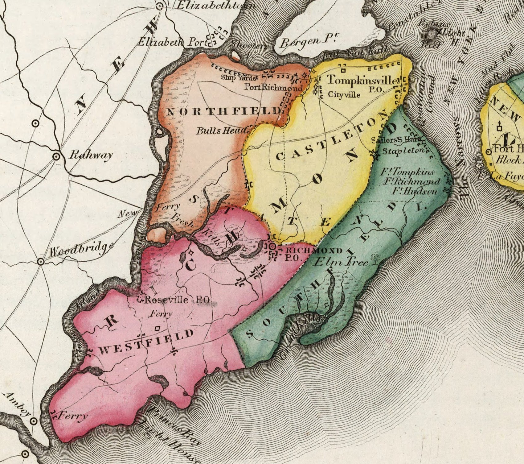
Image: Richmond County (Staten Island) cropped from Richmond Queens Kings counties map by David Burr 1839
Size of this preview: 678 × 600 pixels. Other resolutions: 271 × 240 pixels | 1,700 × 1,504 pixels.
Original image (1,700 × 1,504 pixels, file size: 760 KB, MIME type: image/jpeg)
Description: Map of original cities in today's New York City
Title: Richmond County (Staten Island) cropped from Richmond Queens Kings counties map by David Burr 1839
Credit: https://www.davidrumsey.com/luna/servlet/detail/RUMSEY~8~1~296698~90068097
Author: David Burr
Usage Terms: Public domain
License: Public domain
Attribution Required?: No
Image usage
The following 4 pages link to this image:

All content from Kiddle encyclopedia articles (including the article images and facts) can be freely used under Attribution-ShareAlike license, unless stated otherwise.
_cropped_from_Richmond_Queens_Kings_counties_map_by_David_Burr_1839.jpg)