
Image: River Great Ouse map

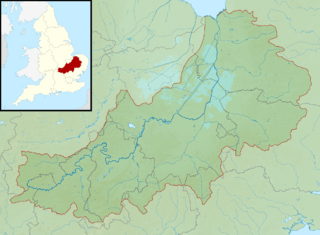
Description: Map of the River Great Ouse and its catchment in England. Map is on British National Grid with limits at grid refs SK4535 (top left), TG1535 (top right), SP4510 (bottom left), TM1510 (bottom right).
Title: River Great Ouse map
Credit: Ordnance Survey OpenData. Relief data and catchment from OS Terrain 50 product. Administrative borders and coastline data from Boundary-Line product. All other geographic data from Meridian 2 product.
Author: Nilfanion, created using Ordnance Survey data
Permission: This file is licensed under the Creative Commons Attribution-Share Alike 3.0 Unported license. Attribution: Contains Ordnance Survey data © Crown copyright and database right You are free: to share – to copy, distribute and transmit the work to remix – to adapt the work Under the following conditions: attribution – You must give appropriate credit, provide a link to the license, and indicate if changes were made. You may do so in any reasonable manner, but not in any way that suggests the licensor endorses you or your use. share alike – If you remix, transform, or build upon the material, you must distribute your contributions under the same or compatible license as the original. https://creativecommons.org/licenses/by-sa/3.0 CC BY-SA 3.0 Creative Commons Attribution-Share Alike 3.0 truetrue
Usage Terms: Creative Commons Attribution-Share Alike 3.0
License: CC BY-SA 3.0
License Link: https://creativecommons.org/licenses/by-sa/3.0
Attribution Required?: Yes
Image usage
The following page links to this image:
