
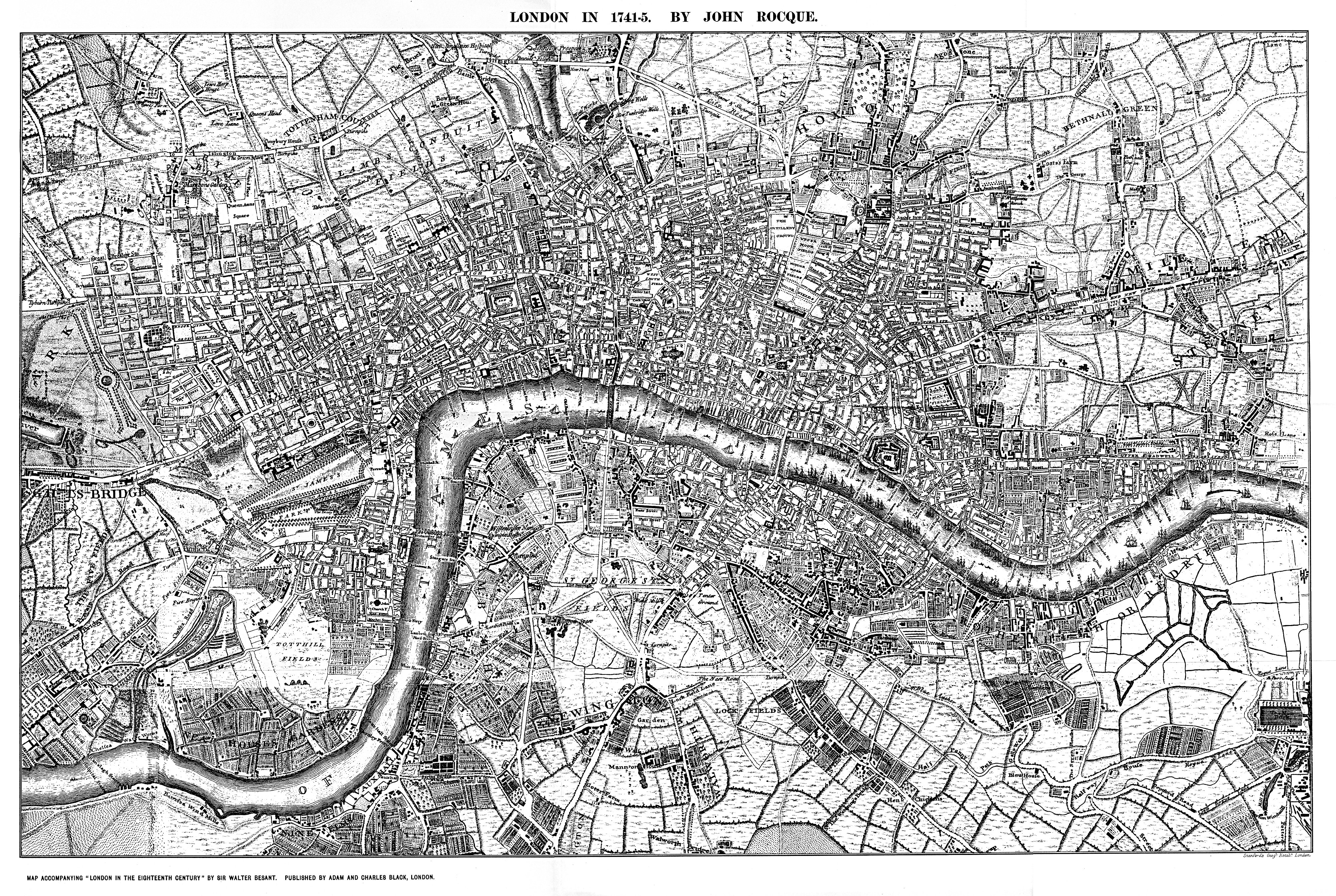
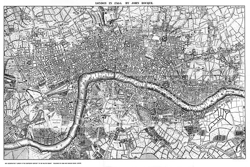
Image: Rocque's Map of London 1741-5
Description: Original of this map is in the British museum, and is 13 feet by 6.75 feet in 24 sheets. This image is not the whole map, but the central portion reproduced in "Maps of Old London", 1908, and is thus missing the turn of the river to the south at the east side of the map (approximately a third of the rightmost sheets). However, the online version of the 1746 edition at www.motco.com, though apparently complete and showing 24 sheets, does not cover all the area shown on this version, which shows Vauxhall and Nine Elms to the south. Rocque has blocked in buildings only where they are adjacent to gardens, fields, and other open ground, not in the central built-up area of the city; this makes his map somewhat clearer than some other historical maps. As with many such images, the dissected sheets are not necessarily accurately re-aligned or copied to the same density in the reproduction originally printed; the scanned image therefore reproduces these faults.
Title: Rocque's Map of London 1741-5
Credit: Mike Calder scan of map reproduced in "Maps of Old London" 1908
Author: Mike Calder corrected scan of reproduction of map by John Rocque
Usage Terms: Public domain
License: Public domain
Attribution Required?: No
Image usage
The following 2 pages link to this image:
