
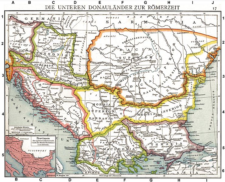
Image: Roman provinces of Illyricum, Macedonia, Dacia, Moesia, Pannonia and Thracia

Size of this preview: 740 × 600 pixels. Other resolutions: 296 × 240 pixels | 2,817 × 2,284 pixels.
Original image (2,817 × 2,284 pixels, file size: 1.41 MB, MIME type: image/jpeg)
Description: The Roman provinces of the Lower Danube. Old historical map from Droysens Historical Atlas, 1886
Title: Roman provinces of Illyricum, Macedonia, Dacia, Moesia, Pannonia and Thracia
Credit: Allgemeiner historischer Handatlas in 96 Karten mit erläuterndem Text Bielefeld, Velhagen & Klasing 1886, S. 16.
Author: Gustav Droysen (1838 — 1908)
Usage Terms: Public domain
License: Public domain
Attribution Required?: No
Image usage
The following 8 pages link to this image:

All content from Kiddle encyclopedia articles (including the article images and facts) can be freely used under Attribution-ShareAlike license, unless stated otherwise.