
Image: Romania general map
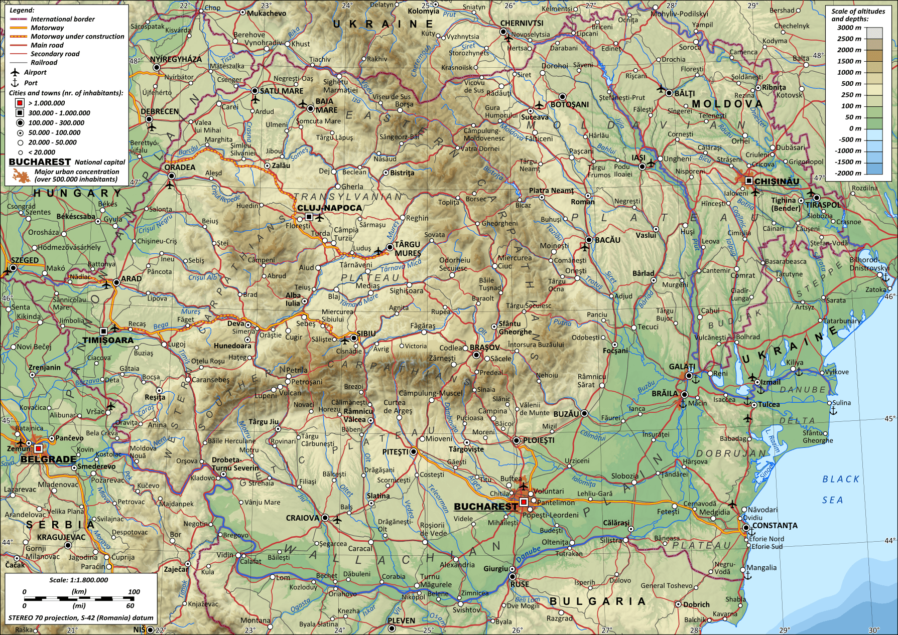
Description: General topographic map of Romania.
Title: Romania general map-en
Credit: Own work STEREO 70 projection ; Pulkovo S-42 datum (Romania); The shaded relief is an embeded bitmap graphic. Light direction: altitude 45, azimuth 315 ; Scale: 1 : 1.800.000 Own work using the following public domain sources: Topography: NASA Shuttle Radar Topography Mission (SRTM3 v.2) data (public domain) Bathymetry: VMap-0 data (public domain); Settlements, roads, railways, shoreline, lakes and rivers: 1:500.000 Topographic maps made by the Soviet General Staff in the 1980's (maps are in the public domain because the USSR did not sign the Bern Convention). Information updated with Landsat ETM+ (public domain) Borders: NGDC World Data Bank II (public domain) Scale, palette and some of the symbols: derived from Image:Maps_template-en.svg by Sting, released under GFDL & CC-BY-SA 2.5. Reference used for confirmation: Romania, Atlas rutier 1:300.000, edited by Stefan Furtuna, Alfa publishing house, Bucharest 2009
Author: Andrein
Usage Terms: Creative Commons Attribution-Share Alike 3.0
License: CC BY-SA 3.0
License Link: http://creativecommons.org/licenses/by-sa/3.0
Attribution Required?: Yes
Image usage
The following image is a duplicate of this image (more details):
The following 2 pages link to this image:
