
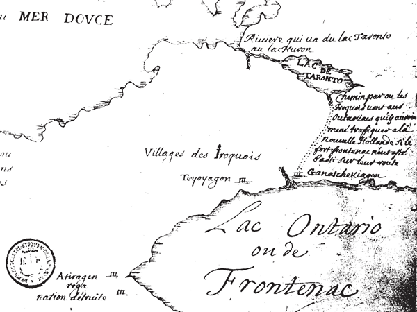
Image: Rouge Trail Map 1673 Louis Jolliet 1673
No higher resolution available.
Rouge_Trail_Map_1673_Louis_Jolliet_1673.png (600 × 450 pixels, file size: 56 KB, MIME type: image/png)
Description: Rouge Trail Map 1673 by Louis Jolliet ca. 1673 Map ascribed to Louis Jolliet (after 1673) showing Ganatchakiagon and the Rouge trail
Title: Rouge Trail Map 1673 Louis Jolliet 1673
Credit: http://www.rougevalleynaturalists.com/about/the-rouge-river/
Author: Louis Jolliet
Usage Terms: Public domain
License: Public domain
Attribution Required?: No
Image usage
The following 3 pages link to this image:

All content from Kiddle encyclopedia articles (including the article images and facts) can be freely used under Attribution-ShareAlike license, unless stated otherwise.