
Image: SAR Map
Size of this preview: 793 × 600 pixels. Other resolutions: 318 × 240 pixels | 1,230 × 930 pixels.
Original image (1,230 × 930 pixels, file size: 570 KB, MIME type: image/jpeg)
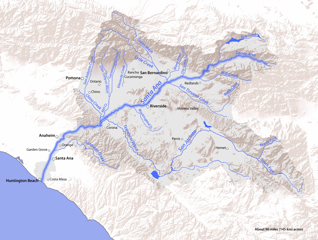
Description: Map of the Santa Ana River drainage basin (watershed) in Orange, Riverside, and San Bernardino Counties, Southern California. From the San Bernardino, Santa Ana, and San Jacinto Mountains to the Pacific Ocean.
Title: SAR Map
Credit: Topography from USGS, rest by me
Author: Shannon1
Usage Terms: Creative Commons Attribution-Share Alike 4.0
License: CC BY-SA 4.0
License Link: https://creativecommons.org/licenses/by-sa/4.0
Attribution Required?: Yes
Image usage
The following 6 pages link to this image:

All content from Kiddle encyclopedia articles (including the article images and facts) can be freely used under Attribution-ShareAlike license, unless stated otherwise.