
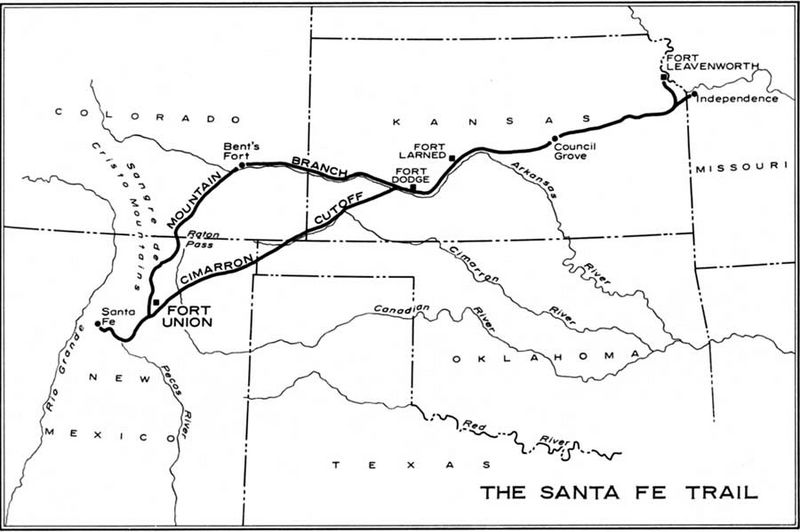
Image: Safe trail map NPS1962

Description: Map of the historic Santa Fe Trail in the southwestern United States as around 1860
Title: Safe trail map NPS1962
Credit: http://www.cr.nps.gov/history/online_books/hh/35/images/hh35b1.jpg - from Robert M. Utley, FORT UNION - National Monument - New Mexico, National Park Service, Historical Handbook Series No. 35, Washington, D.C., 1962
Author: NPS Graphics
Permission: This image or media file contains material based on a work of a National Park Service employee, created as part of that person's official duties. As a work of the U.S. federal government, such work is in the public domain in the United States. See the NPS website and NPS copyright policy for more information.
Usage Terms: Public domain
License: Public domain
Attribution Required?: No
Image usage
The following 2 pages link to this image:
