
Image: Sahel Map-Africa rough

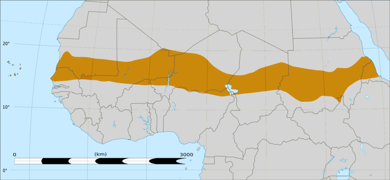
Description: Map of Africa, with the Sahel highlighted in orange. This is roughly the African land area between the lines of 200mm (north) and 600mm (south) mean 20th century annual rainfall. This is limited to land areas directly to the south of the Sahara desert and including the islands of Cape Verde, but not including other areas in Africa with the same rainfall statistics. This is one, but not the only, definition of the Sahel region.
Title: Sahel Map-Africa rough
Credit: Felix Koenig: "created/photographed by myself (based on the existing blank map of Africa)" Photographer/illustrator: Felix Koenig (King)Blank map of Africa Map_sahel.jpg BlankMap-Africa2.png
Author: Map_sahel.jpg: King BlankMap-Africa2.png: Sadalmelik
Usage Terms: GNU Free Documentation License
License: GFDL
License Link: http://www.gnu.org/copyleft/fdl.html
Attribution Required?: Yes
Image usage
