
Image: SanJoaquin watershed
No higher resolution available.
SanJoaquin_watershed.png (300 × 341 pixels, file size: 56 KB, MIME type: image/png)
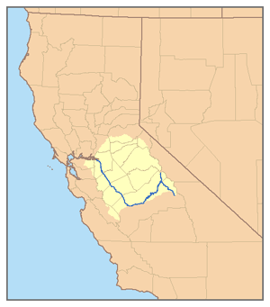
Description: This is a map of the San Joaquin River course and its watershed, the San Joaquin Basin — in the San Joaquin Valley, California. I, Pfly, made it, based on USGS data.
Title: SanJoaquin watershed
Credit: Own work
Author: Pfly
Usage Terms: Creative Commons Attribution-Share Alike 2.5
License: CC BY-SA 2.5
License Link: http://creativecommons.org/licenses/by-sa/2.5
Attribution Required?: Yes
Image usage
There are no pages that link to this image.

All content from Kiddle encyclopedia articles (including the article images and facts) can be freely used under Attribution-ShareAlike license, unless stated otherwise.