
Image: Sanborn Fire Insurance Map from Caldwell, Canyon County, Idaho. Sanborn Map Company, Jul, 1911. Map
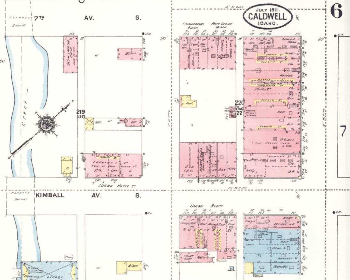
Description: The Caldwell Historic District is partially mapped on the upper right of the image. Not shown is the Ballantyne Building outside lower right. Starting at top center then right, the buildings are Lowell Block, Rice Building, Commercial Building; down, the buildings are Commercial Building, Steunenberg Block, Egleston Block, Roberts Building, Creative Printing, Oakes Brothers Store, Harmon Building. Across Kimball, lower right, Western Building.
Title: Sanborn Fire Insurance Map from Caldwell, Canyon County, Idaho. Sanborn Map Company, Jul, 1911. Map
Credit: Sanborn Fire Insurance Map from Caldwell, Canyon County, Idaho, Jul, 1911, Map. https://www.loc.gov/item/sanborn01576_006/
Author: Sanborn Map Company
Usage Terms: Public domain
License: Public domain
Attribution Required?: No
Image usage
The following page links to this image:
