
Image: Santa Susana State Historic Park Map
Size of this preview: 629 × 600 pixels. Other resolutions: 252 × 240 pixels | 662 × 631 pixels.
Original image (662 × 631 pixels, file size: 489 KB, MIME type: image/png)
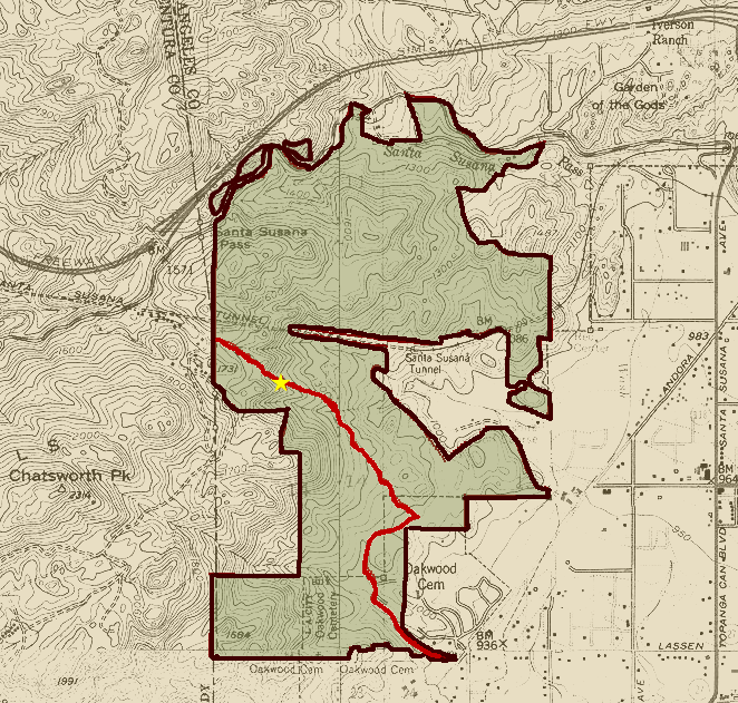
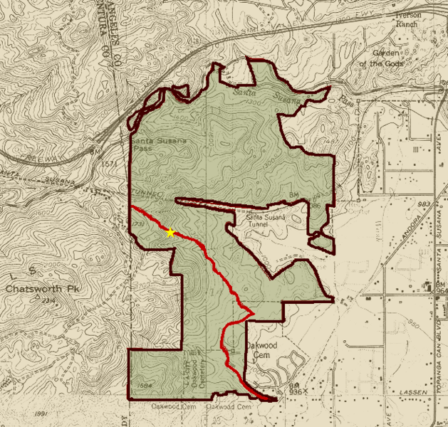
Description: Map of Santa Susana Pass State Historic Park near Chatsworth, California. The park includes the Old Santa Susana Stage Road (in red), a 174-acre National Register of Historic Places property which is also a Ventura County Historical Landmark #104 and Los Angeles City Historic-Cultural Monument #92 (under the name Old Stagecoach Trail). The star marks the historic plaque for the stage road. Map based on park map at California Department of Parks and Recreation Santa Susana Pass State Historic Park Preliminary General Plan/Draft EIR
Title: Santa Susana State Historic Park Map
Credit: Own work
Author: PKM
Usage Terms: Public domain
License: Public domain
Attribution Required?: No
Image usage
The following 2 pages link to this image:

All content from Kiddle encyclopedia articles (including the article images and facts) can be freely used under Attribution-ShareAlike license, unless stated otherwise.