
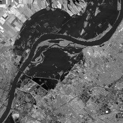
Image: Satellite image of Missouri River during Great Flood of 1993
No higher resolution available.
Satellite_image_of_Missouri_River_during_Great_Flood_of_1993.jpg (250 × 250 pixels, file size: 19 KB, MIME type: image/jpeg)
Description: Satellite image of the Missouri River at Chesterfield Valley in 1993
Title: Satellite image of Missouri River during Great Flood of 1993
Credit: http://www.crh.noaa.gov/lsx/?n=1993_flood
Author: National Weather Service: National Oceanic and Atmospheric Administration
Usage Terms: Public domain
License: Public domain
Attribution Required?: No
Image usage
The following page links to this image:

All content from Kiddle encyclopedia articles (including the article images and facts) can be freely used under Attribution-ShareAlike license, unless stated otherwise.