
Image: Scilly Isles Locator Map
Size of this preview: 360 × 599 pixels. Other resolutions: 144 × 240 pixels | 1,000 × 1,665 pixels.
Original image (1,000 × 1,665 pixels, file size: 246 KB, MIME type: image/png)
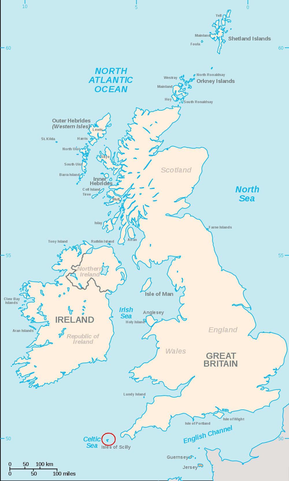
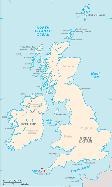
Description: A map of the British Isles, with the largest islands and archipelagos labelled and a red circle around the Scilly Isles.
Title: Scilly Isles Locator Map
Credit: File:British Isles.svg
Author: User:Smurrayinchester made original map, red circle added by Ruhrfisch (talk)
Usage Terms: Creative Commons Attribution-Share Alike 3.0
License: CC-BY-SA-3.0
License Link: http://creativecommons.org/licenses/by-sa/3.0/
Attribution Required?: Yes
Image usage
The following page links to this image:

All content from Kiddle encyclopedia articles (including the article images and facts) can be freely used under Attribution-ShareAlike license, unless stated otherwise.