
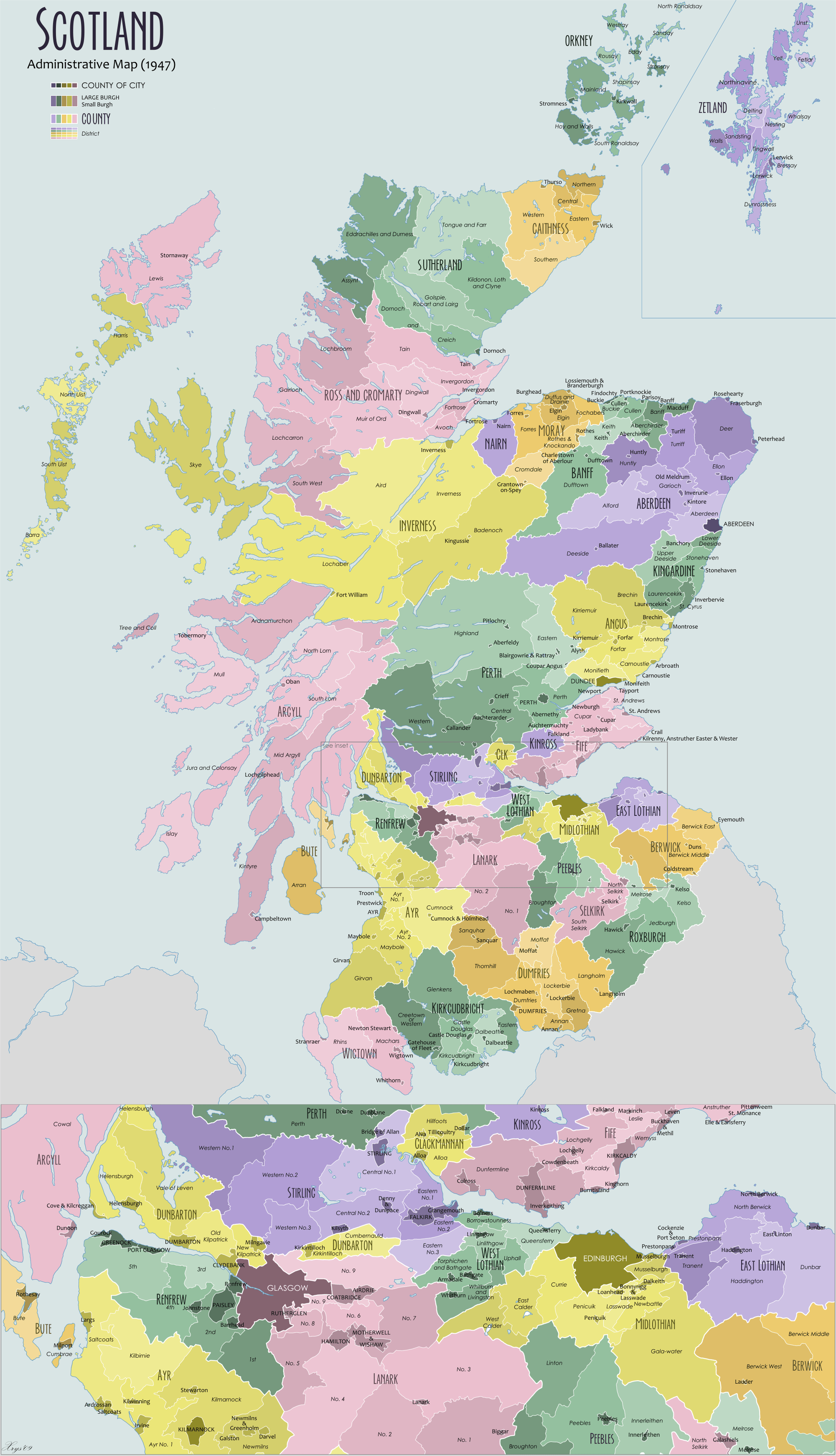
Image: Scotland Administrative Map 1947
Size of this preview: 345 × 600 pixels. Other resolutions: 138 × 240 pixels | 2,001 × 3,480 pixels.
Original image (2,001 × 3,480 pixels, file size: 2.32 MB, MIME type: image/png)
Description: Administrative map of Scotland in 1947. Showing Counties and Districts, Counties of Cities, Large and Smal Burghs
Title: Scotland Administrative Map 1947
Credit: Own work
Author: XrysD
Usage Terms: Creative Commons Attribution-Share Alike 3.0
License: CC-BY-SA-3.0
License Link: http://creativecommons.org/licenses/by-sa/3.0/
Attribution Required?: Yes
Image usage
The following 3 pages link to this image:

All content from Kiddle encyclopedia articles (including the article images and facts) can be freely used under Attribution-ShareAlike license, unless stated otherwise.