
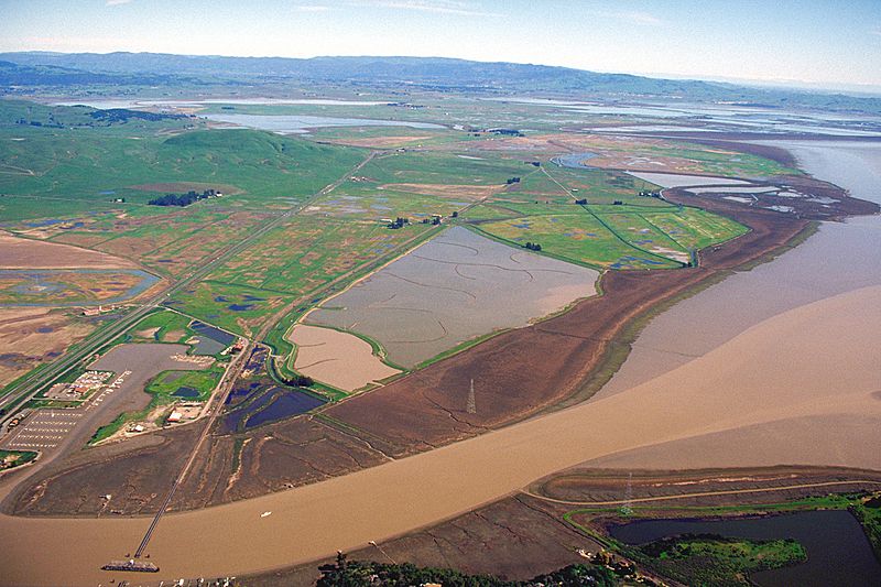
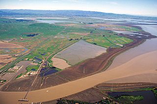
Image: Sears Point California aerial view

Description: Sears Point in Sonoma County, California, USA. Sears Point is the end of a range of hills or low mountains ending at the northern end of San Pablo Bay and the Napa Sonoma Marsh, which is the flat marshy land across the picture. The Petaluma River flows into the bay at the bottom of the picture.
Title: Sears Point California aerial view
Credit: U.S. Army Corps of Engineers Digital Visual Library Image page Image description page Digital Visual Library home page
Author: U.S. Army Corps of Engineers, photographer not specified or unknown
Permission: This image or file is a work of a U.S. Army Corps of Engineers soldier or employee, taken or made as part of that person's official duties. As a work of the U.S. federal government, the image is in the public domain. English | italiano | Nederlands | русский | Türkçe | українська | +/−
Usage Terms: Public domain
License: Public domain
Attribution Required?: No
Image usage
The following 2 pages link to this image:
