
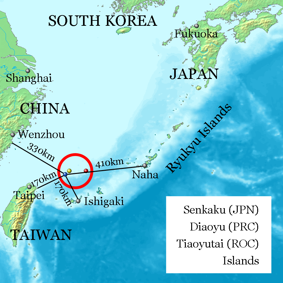
Image: Senkaku Diaoyu Tiaoyu Islands
Description: Uotsuri-shima / Diaoyu Dao (Blue, west end and nearly south end, 25°44′33″N 123°28′17″E at Mount Narahara), Kuba-shima / Huangwei Yu (Yellow, north end, 25°55′24″N 123°40′51″E at Mount Chitose), Taishō-tō / Chiwei Yu (Red, east end, 25°55′21″N 124°33′36″E at the peek) referenced on Geospatial Information Authority of Japan and distances referenced on Ministry of Foreign Affairs of Japan. Every distances of the map show coast to coast, but distances of the coast of Okinawa Island and Naha City, and the coast of Ishigaki-Island and Ishigaki City are quite near on the map.
Author: Jackopoid
Usage Terms: Creative Commons Attribution-Share Alike 3.0
License: CC-BY-SA-3.0
License Link: http://creativecommons.org/licenses/by-sa/3.0/
Attribution Required?: Yes
Image usage
The following page links to this image:
