
Image: Sequoyah map
Size of this preview: 546 × 599 pixels. Other resolutions: 219 × 240 pixels | 4,390 × 4,820 pixels.
Original image (4,390 × 4,820 pixels, file size: 9.65 MB, MIME type: image/jpeg)
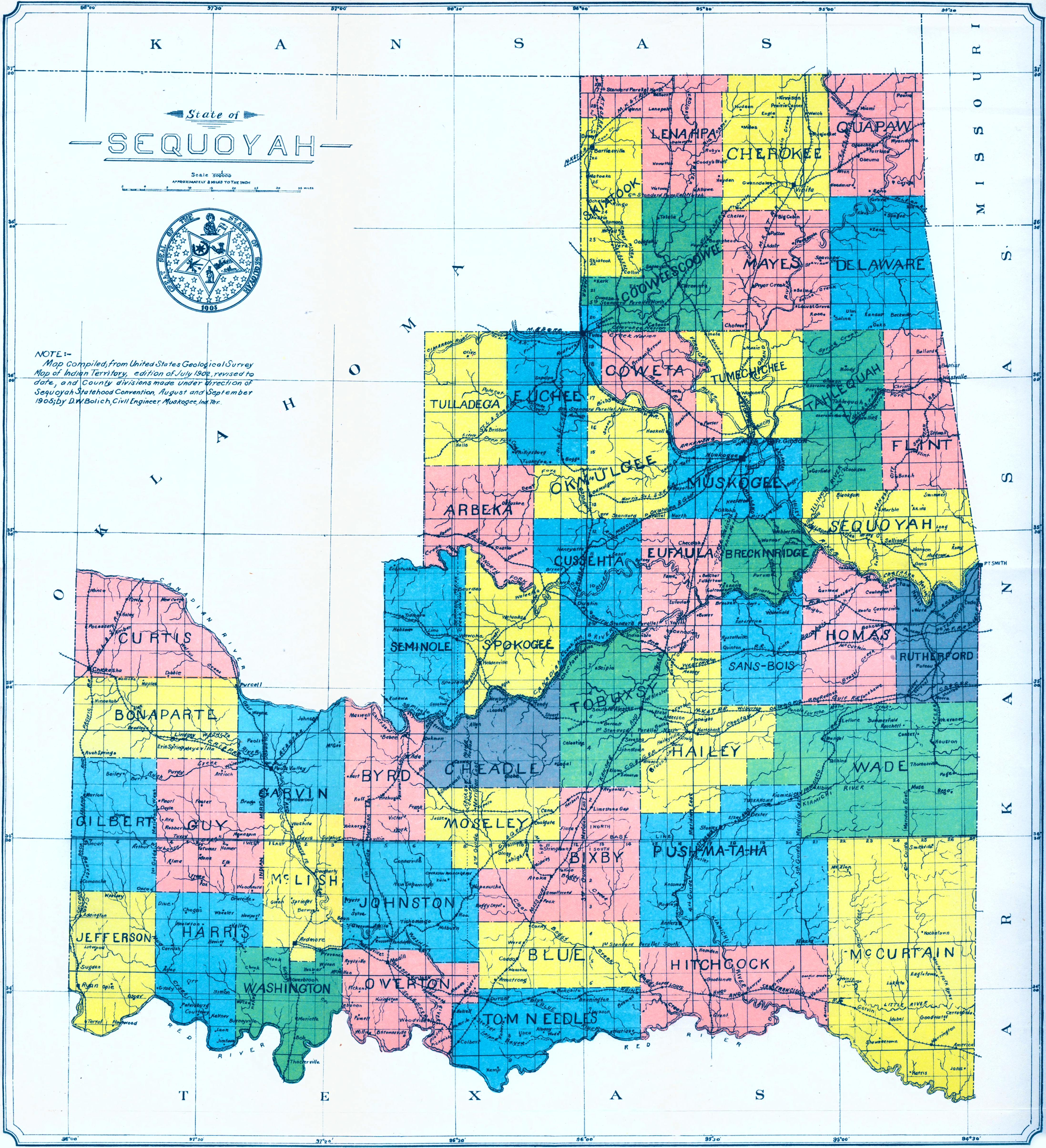
Description: This map of the ‘State of Sequoyah’ - complete with a proposed State Seal - was compiled from the USGS Map of Indian Territory (1902), revised to include the county divisions made under direction of Sequoyah Statehood Convention (1905), by D.W. Bolich, a civil engineer at Muskogee. It was found at this page of the McCasland Digital Collection of Early Oklahoma & Indian Territory Maps at the Oklahoma State University Library.
Title: Sequoyah map
Credit: http://www.library.okstate.edu/scua/collect/maps/index.htm
Author: D.W. Bolich
Usage Terms: Public domain
License: Public domain
Attribution Required?: No
Image usage
The following 4 pages link to this image:

All content from Kiddle encyclopedia articles (including the article images and facts) can be freely used under Attribution-ShareAlike license, unless stated otherwise.