
Image: Sewall's Map of York, Maine, 1794
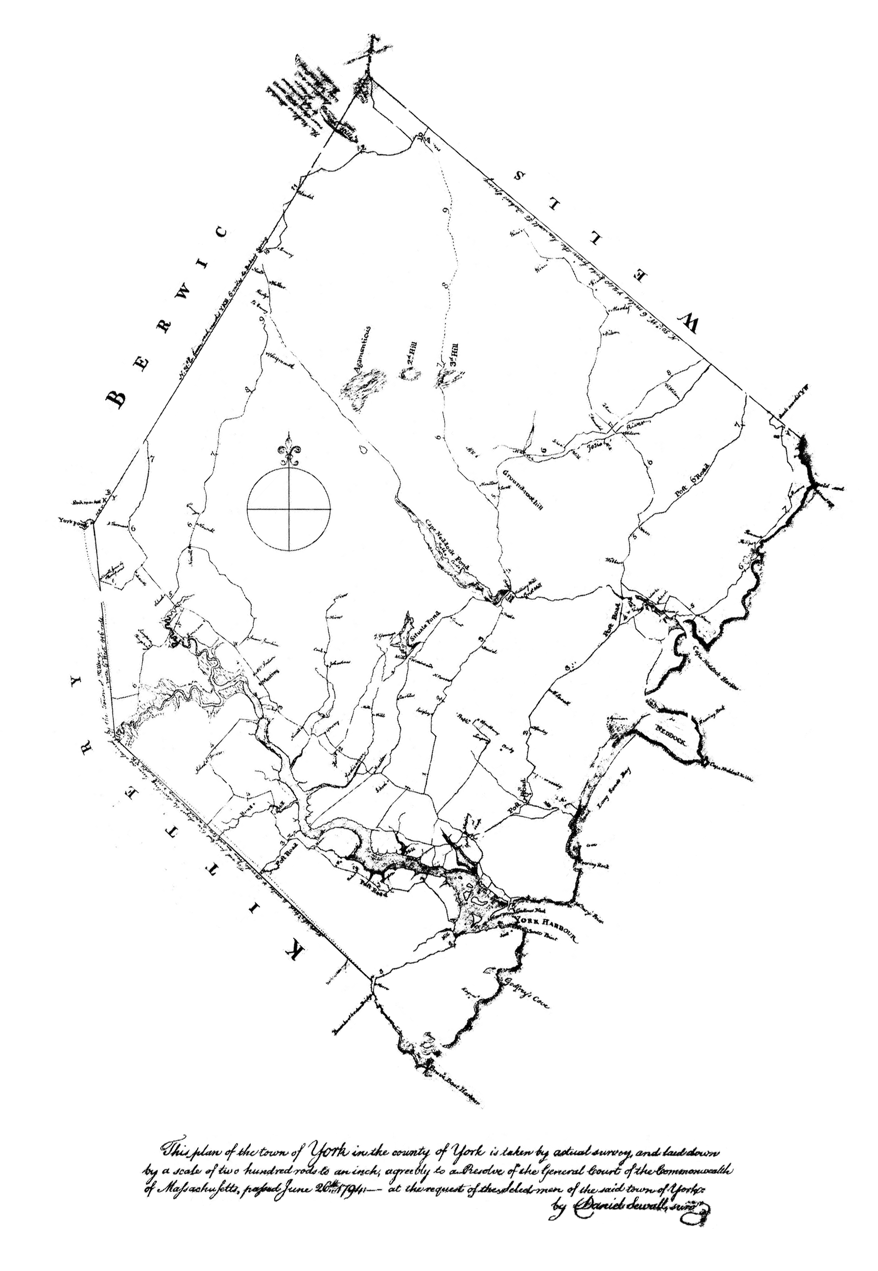
Description: This is a cleaned-up version of the digital image of this map, available to the public through the website of the town offices of York, ME (see source link). I rotated the map from the original to orient it north/south, and moved the legend to what is now the bottom. It reads: "This plan of the town of York in the county of York is taken by actual survey and laid down by a scale of two hundred rods to an inch, agreeably to a Resolve of the General Court of the Commonwealth of Massachusetts, passed June 26th, 1794 - at the request of the Selectmen of the said town of York. by Daniel Sewall, surv."
Title: Sewall's Map of York, Maine, 1794
Credit: Town of York, ME: http://www.yorkmaine.org/LinkClick.aspx?fileticket=rjF1qIZKbbA%3d&tabid=183
Author: Daniel Sewall
Usage Terms: Public domain
License: Public domain
Attribution Required?: No
Image usage
The following page links to this image:
