
Image: ShropshireCountyMap2009
Size of this preview: 535 × 599 pixels. Other resolutions: 214 × 240 pixels | 750 × 840 pixels.
Original image (750 × 840 pixels, file size: 376 KB, MIME type: image/jpeg)
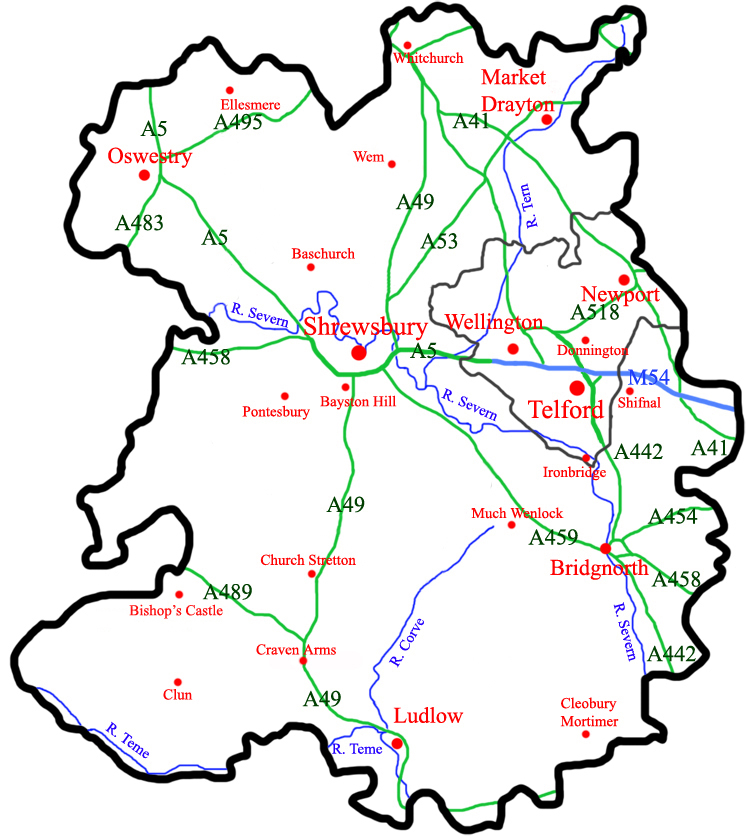
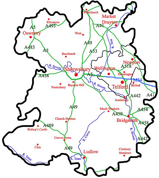
Description: A map of the Ceremonial county of Shropshire, England with the proposed boundaries for 2009. In 2009 the districts of non-metropolitan Shropshire will be abolished and one unitary authority will replace it. The borough of Telford & Wrekin, which is ceremonially part of Shropshire, is unaffected, as it has been a unitary authority since 1998.
Title: ShropshireCountyMap2009
Credit: self-made
Author: ChrisJB (talk)
Usage Terms: Creative Commons Attribution 3.0
License: CC-BY-3.0
License Link: https://creativecommons.org/licenses/by/3.0/
Attribution Required?: Yes
Image usage
The following page links to this image:

All content from Kiddle encyclopedia articles (including the article images and facts) can be freely used under Attribution-ShareAlike license, unless stated otherwise.