
Image: Sketch map of the Great Dismal Swamp RMG K1082
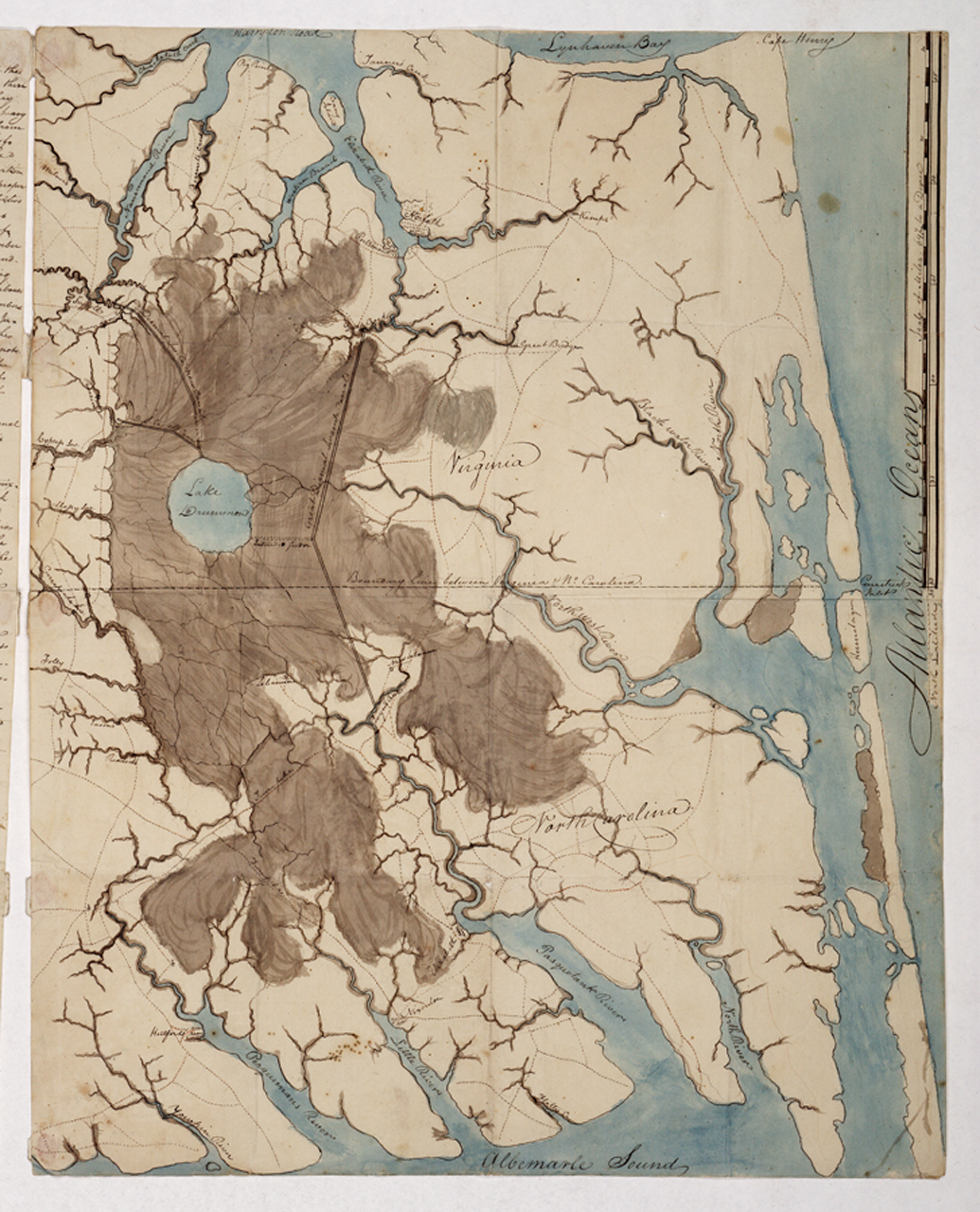
Description: [Sketch map of the Great Dismal Swamp]Single sheet. Col. ms. Scale: 1:200 000 (bar). Cartographic Note: Scale in miles. Additional Places: Virginia, North Carolina. Contents Note: Shows the Great Dismal Swamp Canal, linking Chesapeake Bay in the north with Albemarle Sound in the south. The sketch is accompanied by a page of text, 'Questions and answers on the Swamp. Answers to Col. Hamilton's questions respecting the Great Dismal Swamp', concerning its length and breadth, the growth of timber, extent of cultivation, canal cutting, seasonal factors and whether any animals are peculiar to the Swamp. Gren78/1 [Sketch map of the Great Dismal Swamp]
Title: Sketch map of the Great Dismal Swamp RMG K1082
Credit: http://collections.rmg.co.uk/collections/objects/542115
Author: AnonymousUnknown author
Permission: The original artefact or artwork has been assessed as public domain by age, and faithful reproductions of the two dimensional work are also public domain. No permission is required for reuse for any purpose. The text of this image record has been derived from the Royal Museums Greenwich catalogue and image metadata. Individual data and facts such as date, author and title are not copyrightable, but reuse of longer descriptive text from the catalogue may not be considered fair use. Reuse of the text must be attributed to the "National Maritime Museum, Greenwich, London" and a Creative Commons CC-BY-NC-SA-3.0 license may apply if not rewritten. Refer to Royal Museums Greenwich copyright.
Usage Terms: Public domain
License: Public domain
Attribution Required?: No
Image usage
The following page links to this image:
