
Image: Smith-Island-Map-2010
Size of this preview: 716 × 599 pixels. Other resolutions: 287 × 240 pixels | 2,127 × 1,780 pixels.
Original image (2,127 × 1,780 pixels, file size: 822 KB, MIME type: image/jpeg)
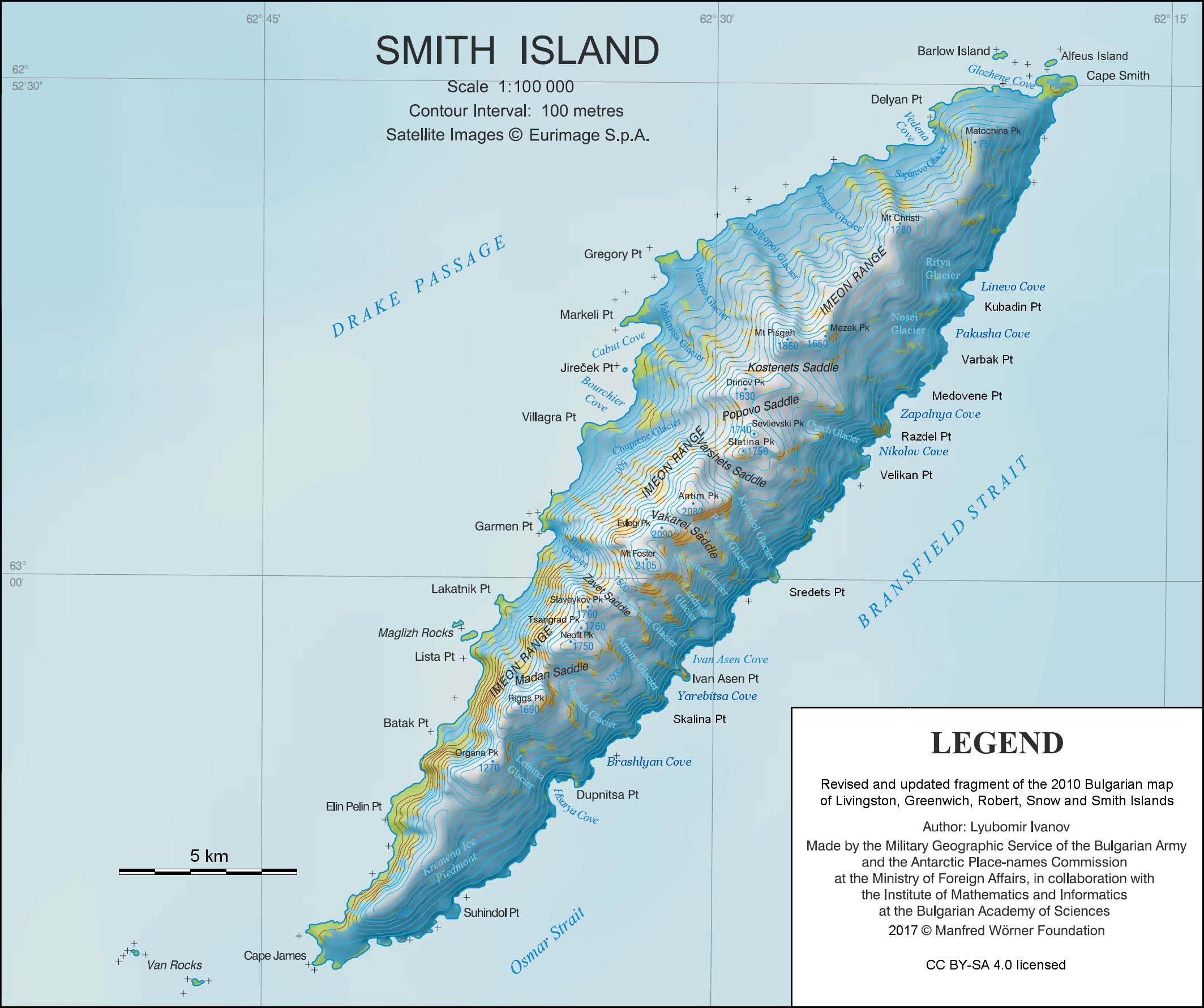
Description: L.L. Ivanov. Antarctica: Smith Island. Scale 1:100000 topographic map. Manfred Wörner Foundation, 2017. Revised and updated version of the first topographic map of Smith Island, fragment of the author’s 2010 map of Livingston Island and Greenwich, Robert, Snow and Smith Islands.
Title: Smith-Island-Map-2010
Credit: Own work
Author: Apcbg
Usage Terms: Creative Commons Attribution-Share Alike 4.0
License: CC BY-SA 4.0
License Link: https://creativecommons.org/licenses/by-sa/4.0
Attribution Required?: Yes
Image usage
The following 2 pages link to this image:

All content from Kiddle encyclopedia articles (including the article images and facts) can be freely used under Attribution-ShareAlike license, unless stated otherwise.