
Image: SnowdonMap

Size of this PNG preview of this SVG file: 545 × 600 pixels. Other resolution: 218 × 240 pixels.
Original image (SVG file, nominally 1,000 × 1,100 pixels, file size: 434 KB)
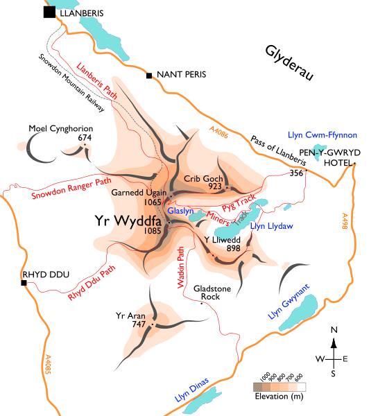
Description: Map of the Snowdon massif, showing the main paths.
Title: SnowdonMap
Credit: Own work. Base mapping is from (public-domain) 1895 edition of M. J. B. Baddeley's Thorough Guide to North Wales. Additional approximate elevation data are cross-referenced from multiple mapping sources, including Ordnance Survey, Google Maps, and personal observations.
Author: User:Stemonitis
Permission: CC attribution ShareAlike 2.5
Usage Terms: Creative Commons Attribution-Share Alike 2.5
License: CC BY-SA 2.5
License Link: https://creativecommons.org/licenses/by-sa/2.5
Attribution Required?: Yes
Image usage
The following 3 pages link to this image:

All content from Kiddle encyclopedia articles (including the article images and facts) can be freely used under Attribution-ShareAlike license, unless stated otherwise.