
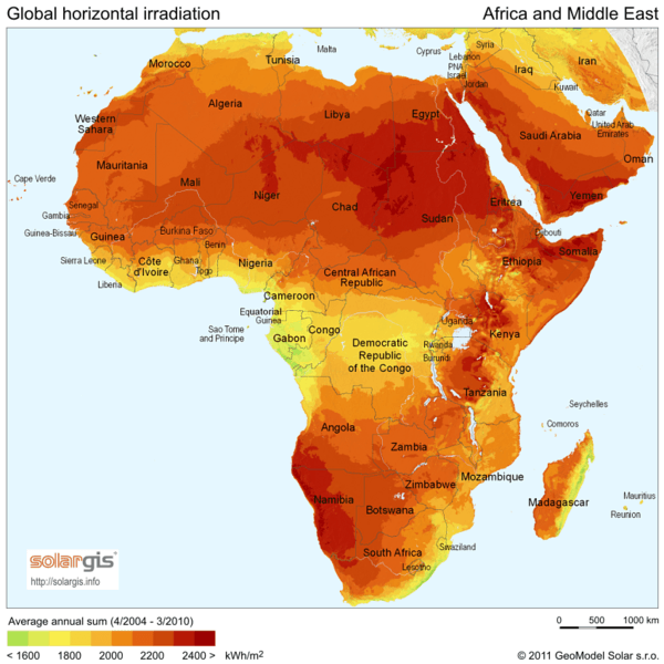
Image: SolarGIS-Solar-map-Africa-and-Middle-East-en

Description: Solar Radiation Map: Global Horizontal Irradiation for Africa and Middle East, SolarGIS 2011
Title: SolarGIS-Solar-map-Africa-and-Middle-East-en
Credit: http://solargis.info/free-solar-maps image
Author: SolarGIS © 2011 GeoModel Solar s.r.o.
Permission: This file, which was originally posted to http://solargis.info/doc/index.php?select=71, was reviewed on 13:56, 31 May 2011 (UTC) by the administrator or reviewer Rillke, who confirmed that it was available there under the stated license on that date. The copyright notice (© 2011 GeoModel Solar s.r.o.) must be displayed in close proximity to each map image or it may be included in a caption if the size of the map image makes the included copyright notice unreadable.
Usage Terms: Creative Commons Attribution-Share Alike 3.0
License: CC BY-SA 3.0
License Link: http://creativecommons.org/licenses/by-sa/3.0
Attribution Required?: Yes
Image usage
The following 2 pages link to this image:
