
Image: Somalia-regions-states 2
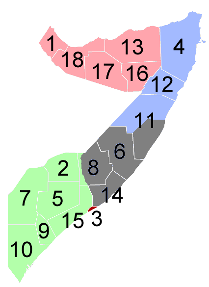
Description: Map of Somalia showing the major self-declared states and areas of factional control. Pink - Somaliland (declared independent, unrecognized) Blue - Puntland (declared autonomous) Orange - controlled by Transitional National Government (TNG) (includes Mogadishu) Purple - Galmudug Grey - No government or local clan rule
Title: Somalia-regions-states 2
Credit: Image created and updated by Sean_II based off: Image:Somalia-Somaliland.png which was created by Wikiacc as a modification of en:Image:Somalia.png Image: Somali land 2007 01 12.png created by Ingoman.
Author: Sean II at English Wikipedia
Usage Terms: Creative Commons Attribution-Share Alike 3.0
License: CC-BY-SA-3.0
License Link: http://creativecommons.org/licenses/by-sa/3.0/
Attribution Required?: Yes
Image usage
There are no pages that link to this image.
