
Image: Somalia map states regions districts

Size of this preview: 582 × 600 pixels. Other resolutions: 233 × 240 pixels | 952 × 981 pixels.
Original image (952 × 981 pixels, file size: 263 KB, MIME type: image/png)
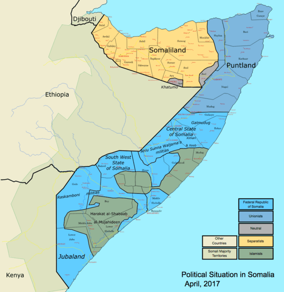
Description: This map shows the states, regions, and districts of Somalia, as well as the current situation in Somalia.
Title: Somalia map states regions districts
Credit: Own work
Author: Ingoman (James Dahl)
Usage Terms: Public domain
License: Public domain
Attribution Required?: No
Image usage

All content from Kiddle encyclopedia articles (including the article images and facts) can be freely used under Attribution-ShareAlike license, unless stated otherwise.