
Image: Somalian Piracy Threat Map 2010

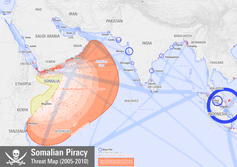
Description: Map showing the extent of Somali pirate attacks on shipping vessels between 2005 and 2010.
Title: Somalian Piracy Threat Map 2010
Credit: Own work Attack Locations: NGA - Maritime Safety Information http://en.wikipedia.org/wiki/List_of_ships_attacked_by_Somali_pirates Shipping Routes: https://www.wired.com/wiredscience/2010/01/global-shipping-map/ Port Data: http://en.wikipedia.org/wiki/List_of_world's_busiest_ports_by_cargo_tonnage Place locations http://osm.org Base map http://www.naturalearthdata.com/ Jolly Roger flag http://commons.wikimedia.org/wiki/File:Pirate_Flag_of_Rack_Rackham.svg
Author: Planemad
Usage Terms: Creative Commons Attribution-Share Alike 3.0
License: CC BY-SA 3.0
License Link: https://creativecommons.org/licenses/by-sa/3.0
Attribution Required?: Yes
Image usage
The following page links to this image:
