
Image: Soo Locks-Sault-Ste Marie
No higher resolution available.
Soo_Locks-Sault-Ste_Marie.png (511 × 494 pixels, file size: 132 KB, MIME type: image/png)
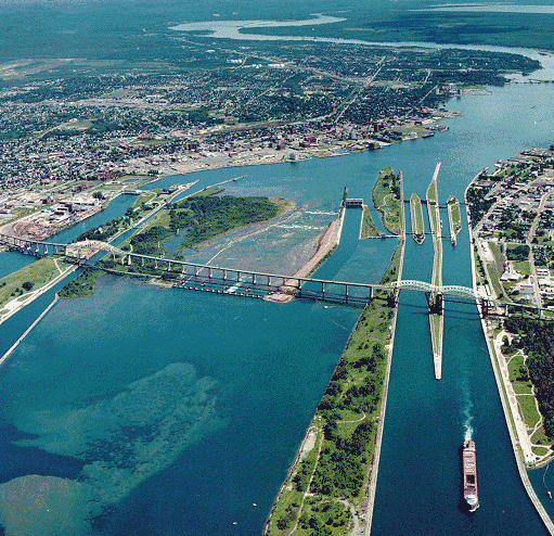
Description: Aerial picture of the Soo Locks (downriver view) — in Michigan between Lake Superior and Lake Huron. Located between the cities of Sault Ste. Marie, Michigan, USA (right) and Sault Ste. Marie, Ontario, Canada (left). Whitefish Island is just to the left of the rapids, with the Canadian Sault Ste. Marie Canal partially in view to its left.
Title: Soo Locks-Sault-Ste Marie
Credit: http://www.lre.usace.army.mil/newsandevents/publications/publications/soolocks-saultste-marie/aerialpicture2/
Author: U.S. Army Corps of Engineers soldier or employee
Usage Terms: Public domain
License: Public domain
Attribution Required?: No
Image usage
The following 11 pages link to this image:
- Great Lakes Waterway
- List of Michigan State Historic Sites in Chippewa County
- List of National Historic Landmarks in Michigan
- List of National Historic Sites of Canada in Ontario
- List of cities, villages, and townships in Michigan
- List of historic places in Northern Ontario
- National Register of Historic Places listings in Chippewa County, Michigan
- Sault Ste. Marie, Ontario
- Soo Locks
- St. Marys River (Michigan–Ontario)
- Whitefish Island

All content from Kiddle encyclopedia articles (including the article images and facts) can be freely used under Attribution-ShareAlike license, unless stated otherwise.