
Image: Source of the Kelvin - geograph.org.uk - 1716279
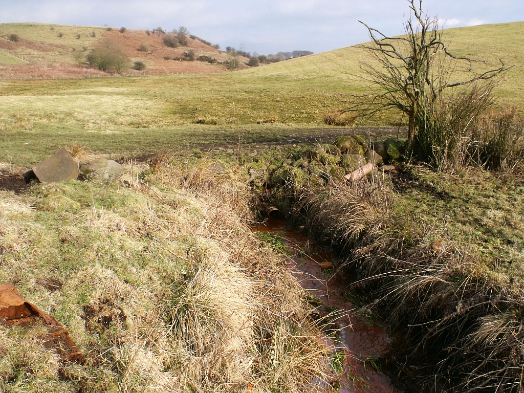
Description: Source of the Kelvin The water in this ditch - discoloured by ochre - can be seen to be flowing (slowly) out of an agricultural drainage pipe - draining the fields known as the 'Meadows' to Bantonians. This is the highest point of water that constitutes the burn then water and finally river Kelvin - it can safely then be claimed to be the source of that river. Bill Gracie, a life long Bantonian in his History of Banton, published in 1995 has this to say on the subject. "The river Kelvin rises in Banton from a marshy area near Lammerknowes (farm, now demolished) from where it flows beneath the tennis courts and the village before turning south and passing under the parish church grounds on its way to Kelvihead where it is piped under the A803." See related photo www.geograph.org.uk/photo/1716256 Let there be no more claims of this river rising in Dullatur bog.
Title: Source of the Kelvin - geograph.org.uk - 1716279
Credit: From geograph.org.uk
Author: BJ Smur
Usage Terms: Creative Commons Attribution-Share Alike 2.0
License: CC BY-SA 2.0
License Link: https://creativecommons.org/licenses/by-sa/2.0
Attribution Required?: Yes
Image usage
The following page links to this image:
