
Image: Sourisrivermap
No higher resolution available.
Sourisrivermap.png (500 × 499 pixels, file size: 141 KB, MIME type: image/png)
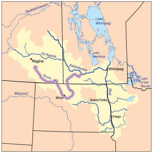
Description: This is a map of the Red River of the North drainage basin, with the Souris River highlighted. I, Karl Musser, created it based on USGS and Digital Chart of the World data.
Title: Sourisrivermap
Credit: No machine-readable source provided. Own work assumed (based on copyright claims).
Author: No machine-readable author provided. Kmusser assumed (based on copyright claims).
Usage Terms: Creative Commons Attribution-Share Alike 2.5
License: CC BY-SA 2.5
License Link: https://creativecommons.org/licenses/by-sa/2.5
Attribution Required?: Yes
Image usage
The following page links to this image:

All content from Kiddle encyclopedia articles (including the article images and facts) can be freely used under Attribution-ShareAlike license, unless stated otherwise.