
Image: South-east Wales rail network map

Size of this PNG preview of this SVG file: 800 × 374 pixels. Other resolution: 320 × 150 pixels.
Original image (SVG file, nominally 2,003 × 936 pixels, file size: 668 KB)
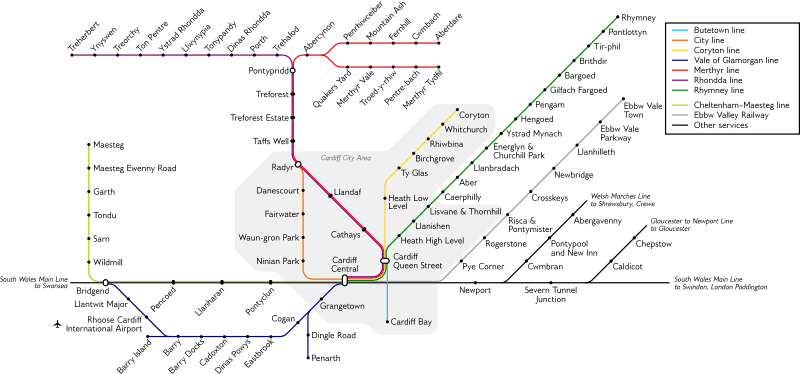
Description: Map of the Valley lines & Cardiff local routes. Font used is Gillius; original text is in a hidden layer for ease of editing.
Title: South-east Wales rail network map
Credit: Own work
Author: Stannered
Permission: Based on en:File:Cardiff Rail Network.jpg, by en:User:Welshleprechaun and en:User:Simply south, which was released to the public domain. Also makes use of BSicon FLUG.svg
Usage Terms: Creative Commons Attribution-Share Alike 4.0
License: CC BY-SA 4.0
License Link: https://creativecommons.org/licenses/by-sa/4.0
Attribution Required?: Yes
Image usage
The following page links to this image:

All content from Kiddle encyclopedia articles (including the article images and facts) can be freely used under Attribution-ShareAlike license, unless stated otherwise.