
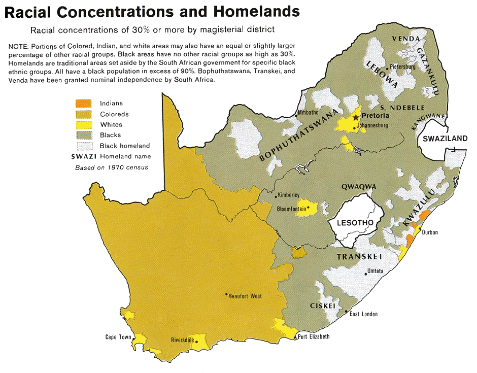
Image: South Africa racial map, 1979
Description: Map showing the territorial four main races/ethnicities/colors of South Africa in 1979: Whites, Coloureds, Blacks and Indians. The gray areas indicate the Apartheid-era Bantustans, which are almost exclusively black. This map is a photoshopped version of the CIA-made original map at Perry Castañeda map collection at the University of Texas website.
Title: South Africa racial map, 1979
Credit: This image is a copy or a derivative work of http://www.lib.utexas.edu/maps/africa/south_africa_racial_1979.jpg, from the map collection of the Perry-Castañeda Library (PCL) of the University of Texas at Austin. This tag does not indicate the copyright status of the attached work. A normal copyright tag is still required. See Commons:Licensing for more information. Transferred from en.wikipedia to Commons by Magnus Manske using CommonsHelper. (Original text : * Site: Perry-Castañeda Library Map Collection: South Africa Maps Image: South Africa - Racial Concentrations and Homelands 1979 from Map No. 503971 1979)
Author: U.S. Central Intelligence Agency
Permission: Public domain
Usage Terms: Public domain
License: Public domain
Attribution Required?: No
Image usage
