
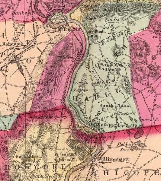
Image: South Hadley Canal (Massachusetts) map

Size of this preview: 533 × 600 pixels. Other resolutions: 213 × 240 pixels | 551 × 620 pixels.
Original image (551 × 620 pixels, file size: 121 KB, MIME type: image/jpeg)
Description: Map of South Hadley Canal and environs, South Hadley, Massachusetts, USA.
Title: South Hadley Canal (Massachusetts) map
Credit: H. F. Walling and Ormando Willis Gray, "Official topographic atlas of Massachusetts", page 46, Boston : Stedman, Brown, & Lyon, 1871. This image has been cropped to remove extraneous terrain.
Author: H. F. Walling and Ormando Willis Gray.
Permission: Public domain - author died more than 70 years ago.
Usage Terms: Public domain
License: Public domain
Attribution Required?: No
Image usage
The following 2 pages link to this image:

All content from Kiddle encyclopedia articles (including the article images and facts) can be freely used under Attribution-ShareAlike license, unless stated otherwise.
_map.jpg)