
Image: Southern ramparts of Buckland Rings iron-age camp viewed from the south - geograph.org.uk - 24952
No higher resolution available.
Southern_ramparts_of_Buckland_Rings_iron-age_camp_viewed_from_the_south_-_geograph.org.uk_-_24952.jpg (640 × 480 pixels, file size: 377 KB, MIME type: image/jpeg)
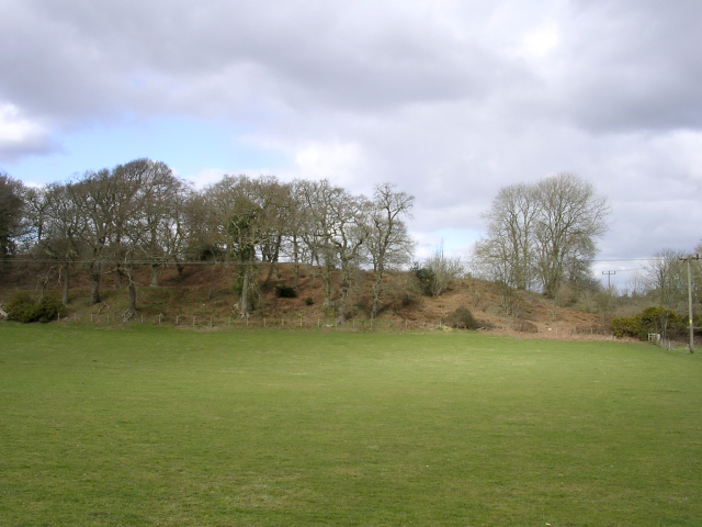
Description: Southern ramparts of Buckland Rings iron-age camp viewed from the south. Looking north at the southern ramparts of Buckland Rings iron-age camp from the field in the fork between the A337 and the Sway road. The camp is not really a hillfort as it isn't on a hill, perhaps a lowland fort is a better description. It looks out eastwards over the Lymington River valley.
Title: Southern ramparts of Buckland Rings iron-age camp viewed from the south - geograph.org.uk - 24952
Credit: From geograph.org.uk
Author: Jim Champion
Usage Terms: Creative Commons Attribution-Share Alike 2.0
License: CC BY-SA 2.0
License Link: https://creativecommons.org/licenses/by-sa/2.0
Attribution Required?: Yes
Image usage
The following page links to this image:

All content from Kiddle encyclopedia articles (including the article images and facts) can be freely used under Attribution-ShareAlike license, unless stated otherwise.