
Image: Southwest Cornwall UK location map

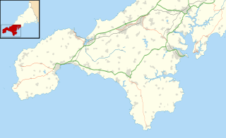
Description: Map of southwest Cornwall, UK (excluding the Isles of Scilly) with the following information shown: Administrative borders Coastline, lakes and rivers Roads and railways Urban areas Equirectangular map projection on WGS 84 datum, with N/S stretched 150% Geographic limits: West: 5.76W East: 4.9W North: 50.29N South: 49.94N
Title: Southwest Cornwall UK location map
Credit: Ordnance Survey OpenData. Administrative borders and coastline data from Boundary-Line product. All other geographic data from Meridian 2 product.
Author: Nilfanion, created using Ordnance Survey data
Permission: This file is licensed under the Creative Commons Attribution-Share Alike 3.0 Unported license. Attribution: Contains Ordnance Survey data © Crown copyright and database right You are free: to share – to copy, distribute and transmit the work to remix – to adapt the work Under the following conditions: attribution – You must give appropriate credit, provide a link to the license, and indicate if changes were made. You may do so in any reasonable manner, but not in any way that suggests the licensor endorses you or your use. share alike – If you remix, transform, or build upon the material, you must distribute your contributions under the same or compatible license as the original. https://creativecommons.org/licenses/by-sa/3.0 CC BY-SA 3.0 Creative Commons Attribution-Share Alike 3.0 truetrue
Usage Terms: Creative Commons Attribution-Share Alike 3.0
License: CC BY-SA 3.0
License Link: https://creativecommons.org/licenses/by-sa/3.0
Attribution Required?: Yes
Image usage
The following 23 pages link to this image:
- Ballowall Barrow
- Boleigh Fogou
- Boscawen-Un
- Boskednan stone circle
- Boswens Menhir
- Carn Euny
- Chysauster Ancient Village
- Chûn Quoit
- Halliggye Fogou
- Lanyon Quoit
- Logan Rock
- Madron Well and Madron Well Chapel
- Mulfra Quoit
- Mên-an-Tol
- Mên Scryfa
- Pendeen Vau
- Sperris Quoit
- The Merry Maidens
- The Pipers, St Buryan
- Tregeseal East stone circle
- Tregiffian Burial Chamber
- West Lanyon Quoit
- Zennor Quoit
