
Image: Spain Balearic Islands location map

Size of this PNG preview of this SVG file: 800 × 520 pixels. Other resolution: 320 × 208 pixels.
Original image (SVG file, nominally 1,539 × 1,000 pixels, file size: 78 KB)
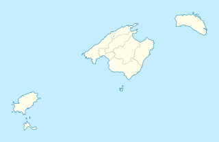
Description: Location map of Balearic Islands
Title: Spain Balearic Islands location map
Credit: Spain_location_map.svg LocBaleares.svg Localització_de_la_Serra_de_la_Tramuntana.png
Author: Spain_location_map.svg: NordNordWest LocBaleares.svg: Miguillen Localització_de_la_Serra_de_la_Tramuntana.png: Unf derivative work: Spischot (talk)
Usage Terms: Creative Commons Attribution-Share Alike 3.0
License: CC BY-SA 3.0
License Link: https://creativecommons.org/licenses/by-sa/3.0
Attribution Required?: Yes
Image usage
The following 57 pages link to this image:
- Alaró
- Algaida
- Andratx
- Ariany, Spain
- Artà
- Banyalbufar
- Binissalem
- Bunyola
- Búger
- Campanet
- Campos, Spain
- Capdepera
- Consell
- Costitx
- Cúber
- Deià
- Es Castell
- Es Migjorn Gran
- Escorca
- Esporles
- Estellencs
- Fornalutx
- Gorg Blau
- Illa de Tagomago
- Illa de s'Espartar
- Inca, Spain
- Lloret de Vistalegre
- Lloseta
- Llubí
- Llucmajor
- Mancor de la Vall
- Maria de la Salut
- Montuïri
- Muro, Mallorca
- Pollença
- Porreres
- Port d'Alcúdia
- Puigpunyent
- Sa Pobla
- Sant Antoni de Portmany (municipality)
- Sant Joan
- Sant Joan de Labritja
- Sant Josep de sa Talaia (municipality)
- Sant Llorenç des Cardassar
- Santa Eugènia
- Santa Margalida
- Santa Maria del Camí
- Santa Ponsa
- Santanyí
- Selva, Mallorca
- Sencelles
- Ses Salines
- Sineu
- Son Servera
- Sóller
- Valldemossa
- Vilafranca de Bonany

All content from Kiddle encyclopedia articles (including the article images and facts) can be freely used under Attribution-ShareAlike license, unless stated otherwise.