
Image: St. Mary's Church, Warrington Road, Lower Ince - geograph.org.uk - 78696
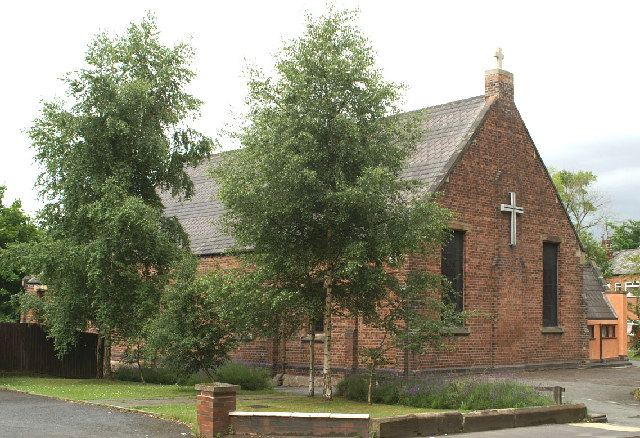
Description: St. Mary's Church, Warrington Road, Lower Ince. The building was formerly part of the Hall of Ince Schools built between 1861 and 1875. The School moved to newer premises in 1974. The building was converted into the Church for the Parish in 1978, after it was decided to demolish the 1887 Paley & Austin church over the road which had become too expensive to repair, through mining subsidence damage.
Title: St. Mary's Church, Warrington Road, Lower Ince - geograph.org.uk - 78696
Credit: From geograph.org.uk
Author: David Long
Usage Terms: Creative Commons Attribution-Share Alike 2.0
License: CC BY-SA 2.0
License Link: https://creativecommons.org/licenses/by-sa/2.0
Attribution Required?: Yes
Image usage
The following 2 pages link to this image:
