
Image: St. Xavier High School (Cincinnati), 2000 aerial

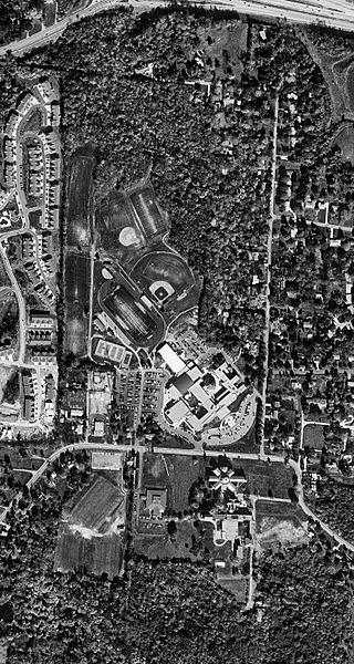
Description: Black-and-white digital orthophoto quadrangle (DOQQ) view of St. Xavier High School in Cincinnati, Ohio, taken in 2000. Visible at the top is Ronald Reagan Cross County Highway at the Winton Road exit. The former Girls' Town of America building is shown fronting North Bend Road in the bottom third of the photograph, just a few months before its demolition. This orthophoto includes the 1998 addition of Keating Natatorium, Holy Companions Chapel, and the science wing but predates the Performance Center and rebuilt St. Xavier Stadium. The bottom 800×100 pixels have been cropped, to remove the USGS logo.
Title: St. Xavier High School (Cincinnati), 2000 aerial
Credit: USGS The National Map, via MSR Maps (formerly TerraServer-USA)
Author: United States Geological Survey (USGS)
Usage Terms: Public domain
License: Public domain
Attribution Required?: No
Image usage
The following 2 pages link to this image:

,_2000_aerial.jpg)