
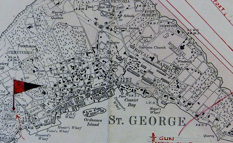
Image: St George's Town and St George's Garrison , Bermuda OS Map Lieut AJ Savage 1901

Size of this preview: 800 × 492 pixels. Other resolutions: 320 × 197 pixels | 2,823 × 1,735 pixels.
Original image (2,823 × 1,735 pixels, file size: 911 KB, MIME type: image/jpeg)
Description: Detail from the Ordnance Survey map of the British colony of Bermuda, produced by Lieutenant Arthur Johnson Savage, Royal Engineers, who surveyed Bermuda between 1897 and 1899, showing St. George's Town and St. George's Garrison, Bermuda. The completed map was first printed in 1901.[1]
Title: St George's Town and St George's Garrison , Bermuda OS Map Lieut AJ Savage 1901
Credit: Photograph from original copy
Author: British Government
Usage Terms: Public domain
License: Public domain
Attribution Required?: No
Image usage
The following 6 pages link to this image:

All content from Kiddle encyclopedia articles (including the article images and facts) can be freely used under Attribution-ShareAlike license, unless stated otherwise.