
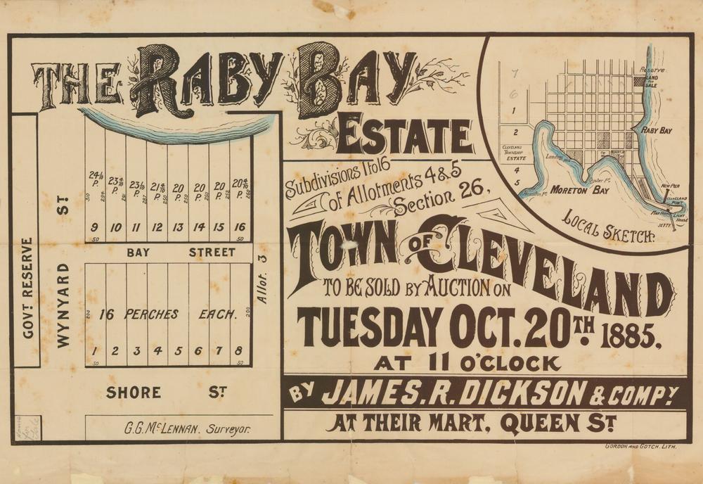
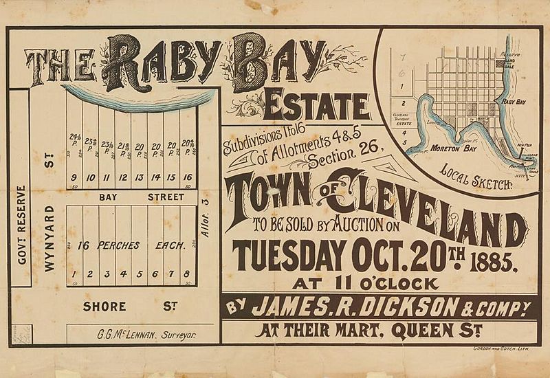
Image: StateLibQld 2 262824 Estate map of Raby Bay Estate, Raby Bay, Queensland, 1885
Size of this preview: 800 × 550 pixels. Other resolutions: 320 × 220 pixels | 1,000 × 688 pixels.
Original image (1,000 × 688 pixels, file size: 124 KB, MIME type: image/jpeg)
Description: Estate map of Raby Bay Estate, Raby Bay, Queensland, 1885 Real estate map showing allotments to be sold on the 20th October, 1885 by James R. Dickson & Co., auctioneer. Plan includes inset with local sketch of the area. The estate includes allotments on Shore Street, Bay Street and Wynyard Street, Raby Bay.
Title: StateLibQld 2 262824 Estate map of Raby Bay Estate, Raby Bay, Queensland, 1885
Credit: Item is held by John Oxley Library, State Library of Queensland.
Usage Terms: Public domain
License: Public domain
Attribution Required?: No
Image usage
The following 2 pages link to this image:

All content from Kiddle encyclopedia articles (including the article images and facts) can be freely used under Attribution-ShareAlike license, unless stated otherwise.