
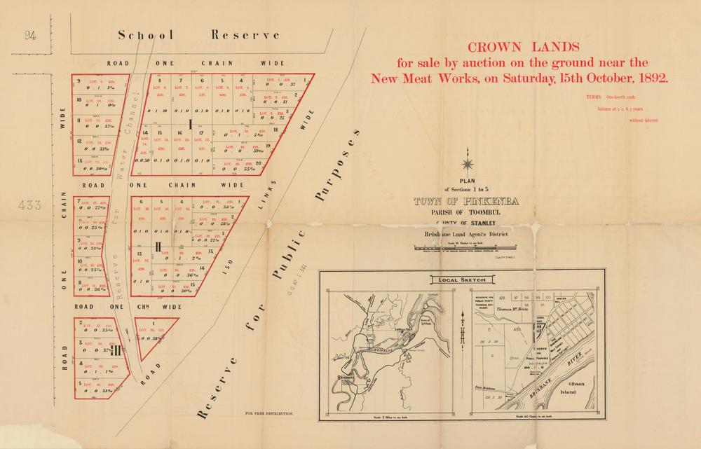
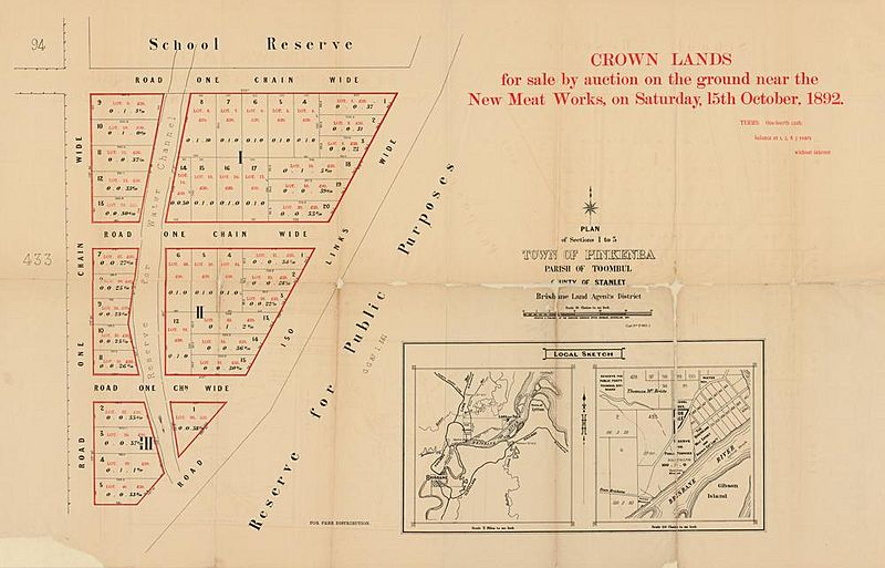
Image: StateLibQld 2 262876 Estate map of the Town of Pinkenba, Brisbane, Queensland, 1892
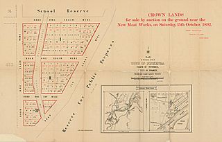
Size of this preview: 800 × 513 pixels. Other resolutions: 320 × 205 pixels | 1,000 × 641 pixels.
Original image (1,000 × 641 pixels, file size: 74 KB, MIME type: image/jpeg)
Description: Estate map of the Town of Pinkenba, Brisbane, Queensland, 1892 Estate map showing allotments to be sold on the grounds near the new meatworks on 25 October 1892. The plan includes a local sketch of the area.
Title: StateLibQld 2 262876 Estate map of the Town of Pinkenba, Brisbane, Queensland, 1892
Credit: Item is held by John Oxley Library, State Library of Queensland.
Usage Terms: Public domain
License: Public domain
Attribution Required?: No
Image usage
The following page links to this image:

All content from Kiddle encyclopedia articles (including the article images and facts) can be freely used under Attribution-ShareAlike license, unless stated otherwise.