
Image: StateLibQld 2 262964 Estate map of Garfield, Paddington, Brisbane, Queensland, 1924
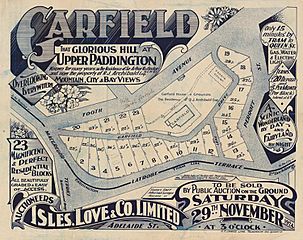
Size of this preview: 756 × 600 pixels. Other resolutions: 303 × 240 pixels | 1,000 × 793 pixels.
Original image (1,000 × 793 pixels, file size: 217 KB, MIME type: image/jpeg)
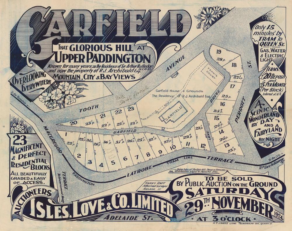
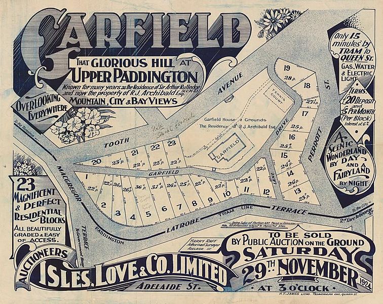
Description: Estate map of Garfield, Paddington, Brisbane, Queensland, 1924 Estate map showing allotments to be sold on 29th November 1924 by Isles, Love & Co., auctioneers. The plan was surveyed by Harry Raff. The estate owned by R. J. Archibald was previously known as the residence of Sir Arthur Rutledge. The land covered an area between Latrobe Terrace, Macgregor Street, Tooth Street and Garfield Drive.
Title: StateLibQld 2 262964 Estate map of Garfield, Paddington, Brisbane, Queensland, 1924
Credit: Item is held by John Oxley Library, State Library of Queensland.
Usage Terms: Public domain
License: Public domain
Attribution Required?: No
Image usage
The following page links to this image:

All content from Kiddle encyclopedia articles (including the article images and facts) can be freely used under Attribution-ShareAlike license, unless stated otherwise.